Is Boston Walkable
Boston answers the walkability question with a number: 2.5 miles. That is the length of the Freedom Trail, the red-brick and red-paint line the Freedom Trail Foundation says links 16 historically significant sites spanning "over 250 years" of history, and it is the spine of a downtown that was laid out for foot traffic and horses long before anyone imagined a car. The National Park Service's own hours-and-fees page for Boston National Historical Park shows that the public walking route is free, with separately ticketed historic interiors. This page lays out what that compactness means in practice: which parts of the city you can genuinely cover on foot, where walking stops being the smart choice, and how the MBTA's fare rules fit around a walking trip. For the wider picture of what to see, start with things to do across Boston.
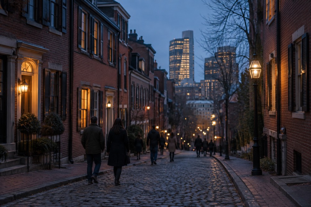
Short answer
Yes, emphatically. Boston's historic core is one of the most pedestrian-friendly downtowns in the United States: a 2.5-mile red-lined route connects 16 historic sites, with a mixture of outdoor stops and separately managed interiors, and the main visitor neighborhoods, downtown, the North End, Beacon Hill, Back Bay and the Waterfront, sit within roughly a 30-minute walk of one another. The street grid predates the automobile by two centuries, blocks are short, and the MBTA fills the gaps for anything beyond the peninsula.
Boston answers the walkability question with a number: 2.5 miles. That is the length of the Freedom Trail, the red-brick and red-paint line the Freedom Trail Foundation says links 16 historically significant sites spanning "over 250 years" of history, and it is the spine of a downtown that was laid out for foot traffic and horses long before anyone imagined a car. The National Park Service's own hours-and-fees page for Boston National Historical Park shows that the public walking route is free, with separately ticketed historic interiors. This page lays out what that compactness means in practice: which parts of the city you can genuinely cover on foot, where walking stops being the smart choice, and how the MBTA's fare rules fit around a walking trip. For the wider picture of what to see, start with things to do across Boston.
Explore the roughly two-and-a-half-hour guided downtown-to-North-End route. It excludes Charlestown and paid interiors. Independent walking remains free; switch below for a longer route, tastings, Harvard or a seated overview with separate access conditions. Check Freedom Trail walk dates
Is Boston Walkable, Really?
Yes, emphatically. Boston's historic core is one of the most pedestrian-friendly downtowns in the United States: a 2.5-mile red-lined route connects 16 historic sites, with a mixture of outdoor stops and separately managed interiors, and the main visitor neighborhoods, downtown, the North End, Beacon Hill, Back Bay and the Waterfront, sit within roughly a 30-minute walk of one another. The street grid predates the automobile by two centuries, blocks are short, and the MBTA fills the gaps for anything beyond the peninsula.
Boston’s historic center has short blocks and irregular streets, but traffic does not automatically yield. The Freedom Trail follows a 2.5-mile route with sixteen sites. Walking time depends on pace, access needs, crossings, weather and stops; allow much longer for interiors than for simply following the route.
The honest caveat is geographic. Boston proper is a set of neighborhoods stitched onto a peninsula, and Cambridge and Somerville are separate cities, while Brookline is a town, not Boston neighborhoods, so a walk that feels short on the downtown map can turn into a long haul once you cross the Charles River. The second caveat is seasonal: NOAA's climate normals for the Boston Logan station show the city averages 49.2 inches of snow a year, with 58% of it falling in January and February alone. Boston is walkable year-round, but winter walking is a different sport.
How Walkable Is Downtown Boston, Neighborhood To Neighborhood?
Downtown Boston's visitor neighborhoods are compact and mutually walkable: Boston Common to Faneuil Hall involves a route with crossings and some slopes, Faneuil Hall to the North End's Hanover Street is a few flat minutes, and Back Bay's Newbury Street to the Public Garden is an easy walk on the flattest ground in the city. Charlestown, across the harbor, and Cambridge, across the river, are the two destinations where most walkers trade their feet for the MBTA. The core itself rarely demands transit at all.
Boston Common is a useful starting point. The route climbs toward the State House before continuing through downtown to Faneuil Hall and Quincy Market, North End and Charlestown. The full trail includes the Navy Yard and ends at Bunker Hill; it is not all downhill.
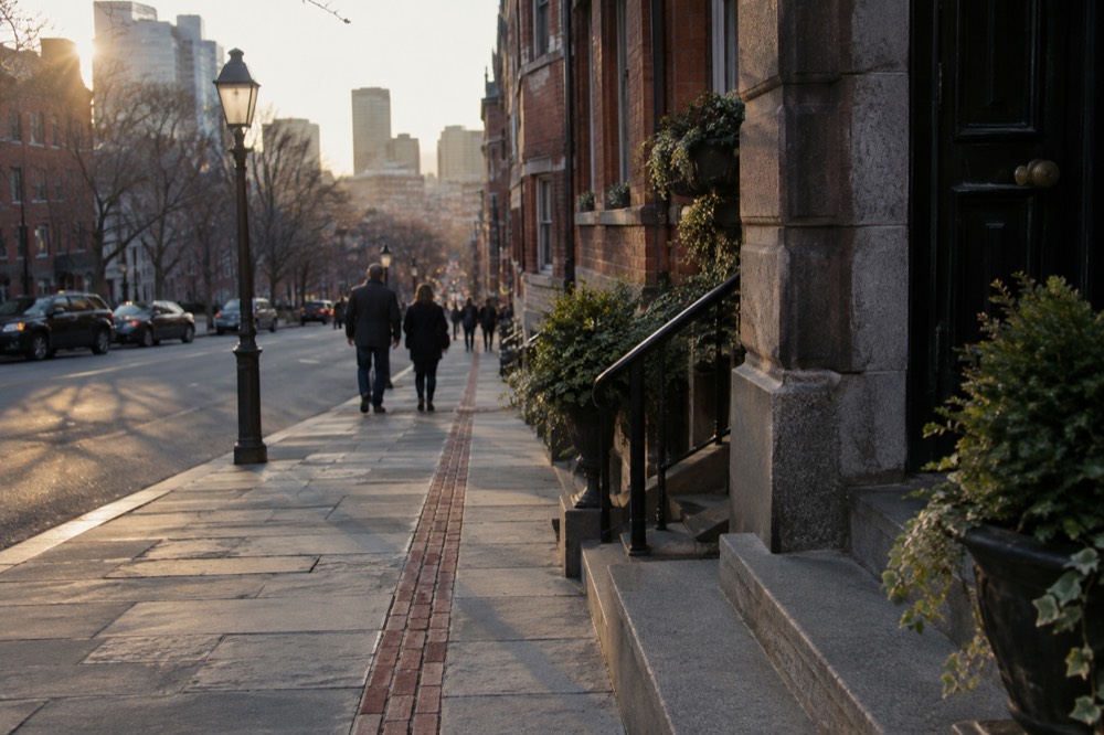
Back Bay runs the other way: an orderly Victorian grid where a "block" is a predictable rectangle, the one part of central Boston where the street pattern is rational rather than historic. The Public Garden connects the two worlds, and the Beacon Hill and Back Bay areas both put you within walking distance of some central sights, with longer journeys for others.
Here is how the main walking legs stack up:
| Walking leg | What it's like on foot |
|---|---|
| Boston Common to Faneuil Hall | Trail climbs toward the State House before continuing through downtown |
| Faneuil Hall to North End (Hanover Street) | Flat, cobblestone in places, busy at mealtimes |
| Public Garden to Newbury Street | Flat, straight, the easiest walk in the city |
| North End to Charlestown Navy Yard | Across the Charlestown Bridge, the longest downtown leg, exposed to wind |
| Downtown to Harvard Square, Cambridge | Long; the Red Line does it in about 20 minutes |
| Back Bay to Fenway Park | Flat down Boylston and Commonwealth, an easy walk |
Two legs in that table deserve a warning. The Charlestown Bridge leg is fine in summer and bracing in winter, since the wind comes straight off the harbor. And the walk to Cambridge is doable along the Charles River Esplanade and its bridges, pleasant on a good day, but most visitors take the Red Line and save their legs for Harvard Yard itself.
The North End rewards walkers more than any other neighborhood in the city, and it punishes cars more than any other: its streets were laid out in the seventeenth century and no one has widened them since. A guided walk there pairs the history with the food, and the North End food and heritage walk is the model most visitors copy.
Do You Need A Car In Boston?
No, and a car is usually a liability. Downtown parking is scarce and expensive, the MBTA's subway fare is $2.40 with unlimited transfers inside a two-hour window under the pilot rules in effect since September 1, 2026, and the Silver Line SL1 from Logan Airport to South Station is free in the airport-bound direction's reverse: boarding at the terminal curb costs nothing. A visitor staying in almost any central neighborhood can spend an entire trip without once sitting behind a wheel.
Prefer to rest your feet between neighborhoods? Book a hop-on hop-off trolley tour here.
Start with the airport, because that is where the car question usually starts. Massport's own to-from-Logan page states that the Silver Line SL1 provides free service between South Station and all airport terminals, from the terminal curb. Read that the way Massport wrote it: the free leg is the one leaving the airport. You board at the curb, pay nothing, and connect to the whole subway network at South Station. Arriving in Boston by transit can genuinely cost zero dollars. The full arrival playbook, including Logan Express and the water taxi, is in the Logan Airport guide and the airport-to-downtown walkthrough.
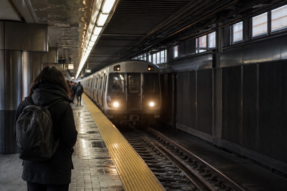
The fare side matters to walkers because you only pay it when walking stops. The MBTA fare table shows subway at $2.40 one-way, a 1-Day Pass at $11.00 and a 7-Day Pass at $22.50. The September 2026 fare pilots changed the arithmetic in a walker's favor: unlimited transfers between subway, bus and ferry within a two-hour window, paying only the highest-priced leg, as long as you use the same payment method throughout. Savings depend on which journeys qualify for the transfer window. The details, including the CharlieCard-versus-CharlieTicket pass-start quirk, are in CharlieCard and fare basics.
One pass detail catches people every week: a 1-Day or 7-Day pass on a CharlieTicket starts at the date and time of purchase, while the same pass on a CharlieCard starts at first use. Buy on arrival evening, sightsee from the next morning, and the CharlieCard version is worth most of a day more than the ticket version. The rest of the planning pages sit on Boston Travel Guide.
Parking, for anyone still tempted, is its own subject: parking in Boston exists as a guide precisely because the answer is rarely pleasant downtown. And if you are weighing a car for day trips instead, the commuter rail and regional options cover Salem, Concord and Providence without one.
Is The Freedom Trail Best Done On Foot?
The Freedom Trail is designed as a public walking route, but you can combine accessible sections with transit according to your needs. Public walking is free. Old State House and Old South share a combined ticket; Paul Revere House, Old North and King’s Chapel church have separate admissions. Ship and monument visits have their own opening and access rules.
The National Park Service publishes the fee structure, and it is the most useful table in Boston for a walker planning a budget day:
| Site | Admission basis | Planning note |
|---|---|---|
| Old State / Old South | Combined adult $18 at check | Count one ticket, check stairs/lift access |
| Paul Revere House | Adult $6; ages 5–17 $1 at check | Open year-round, seasonal hours |
| Old North | Discovery/bell formats differ | Bell tour has stairs |
| King’s Chapel church | Separate ticket | Distinct from burying ground |
| USS Constitution | Free when open | Navy screening and ship access rules |
| Bunker Hill | Free when open | Monument climb has no elevator |
| Faneuil Hall | Free when open | Events can affect access |
| Constitution Museum | Suggested donation | Separate from Navy ship |
Source for all figures: the NPS hours-and-fees page for Boston National Historical Park. The Paul Revere House rate there is the $6.00 adult figure, corroborated by the NPS.
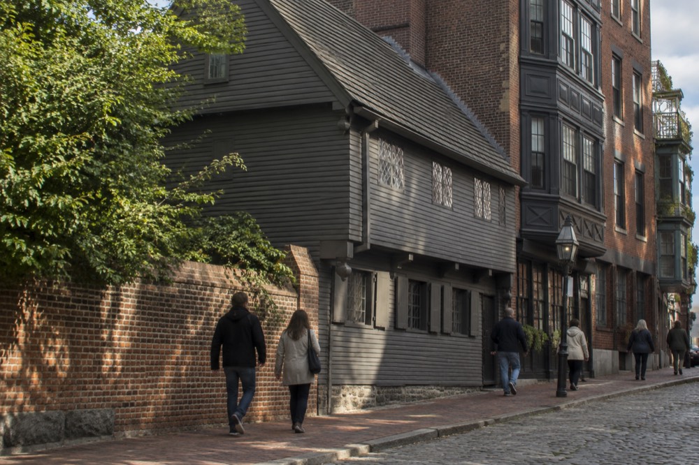
Independent walking is free. A guide adds interpretation and a defined route. The tour comparison distinguishes the roughly two-and-a-half-hour downtown-to-North-End walk from the four-hour Charlestown-inclusive walk. The latter requires age twelve or over and suitable walking fitness; ship entry and a monument climb are not guaranteed.
Where Does Walking Boston Get Hard?
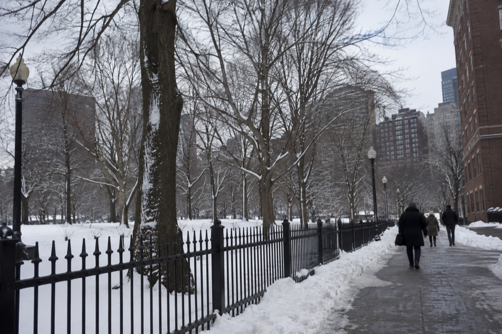
Three things make walking Boston harder than the map suggests: winter snow, at 49.2 inches a year with 58% of it in January and February; the Charlestown and harbor crossings, which are long and wind-exposed; and the MBTA's rolling weekend closures, which can strand a walker's transit backup, including a full central Green Line suspension on the weekend of September 19-20, 2026. None of these make the city unwalkable, but each changes what you should plan for.
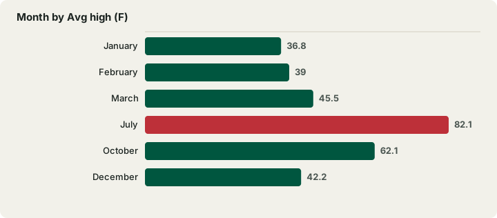
Weather requires a travel-date forecast as well as seasonal context. NOAA's 1991-2020 climate normals for the Logan station show no wet season and no dry season: every month sits between 3.21 and 4.30 inches of precipitation, barely an inch of spread across the whole year. What Boston has instead is a snow season, concentrated brutally in two months:
| Month | Avg high (F) | Avg low (F) | Snow (in) |
|---|---|---|---|
| January | 36.8 | 23.1 | 14.3 |
| February | 39.0 | 24.6 | 14.4 |
| March | 45.5 | 31.1 | 9.0 |
| July | 82.1 | 66.0 | 0.0 |
| October | 62.1 | 47.5 | 0.2 |
| December | 42.2 | 29.2 | 9.0 |
Source: NOAA NCEI monthly climate normals, station USW00014739, Boston Logan. The month-by-month detail, including which months reward walkers most, is in Boston weather by month and the best time to visit Boston.
The transit caveat is the one most guides miss. The MBTA has been running planned weekend closures through September and into October 2026 for track work, with free shuttles provided, and Symphony station on the Green Line E branch has been closed since June with closure scheduled through spring 2029. A walker's rule of thumb: check the T's service alerts the night before any day that depends on a Green Line branch, and treat the subway map guide as your fallback plan rather than a fixed promise.
Beacon Hill and Charlestown slopes, brick surfaces and uneven paving can be significant for some visitors. Do not minimize these access constraints. Check a suitable route, allow breaks and use the packing guide for weather planning.
Can You Walk From Boston To Cambridge And The Harbor?
You can, and both walks are among the best in the region, but they are commitments. The Charles River Esplanade's paths and footbridges connect Back Bay to Cambridge in a pleasant hour of walking, while the harbor side runs the Harborwalk past the North End and Seaport, with the caveat that the Boston Harbor Islands ferry season ends on October 12, 2026, and the Swan Boats are closed until April 2027. Walking to Cambridge is a choice; offshore islands require water transport; some park areas such as Deer and Nut islands are connected to the mainland.
Harvard Bridge reaches the MIT area, while Longfellow Bridge reaches Kendall Square; neither places you next to Harvard Yard. Harvard Square is farther along the river and is served by the Red Line. The Harvard guide covers campus access, free registered university historical tours and independent options.
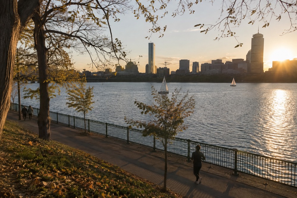
Harborwalk includes sections around North End and Seaport, with gaps, opening hours and diversions. NOAA station 8443970’s mean tidal range is about 9.49 feet; a tide-level observation is not a record tidal range. For islands, check the selected island/date ferry and return; the October 12 season endpoint does not imply daily service to every island. See the Harbor Islands guide.
One seasonal trap to flag now: the Swan Boats' own site says, verbatim, "Closed for the season. See you in April 2027." Any page telling you to ride them this autumn or winter is wrong, and the Swan Boats guide exists partly so this site never joins them.
Is Boston Walkable With Kids Or Limited Mobility?
Choose the specific route for your party’s mobility, stamina and equipment. Paved parks and waterfront sections can help, but ramps, surfaces, gaps, hills and elevator outages vary. Bunker Hill’s climb has no elevator, historic interiors differ, and bridge legs can be long. Check current station access and the actual attraction route.
The flat and easy list is long: the Rose Kennedy Greenway, the Public Garden, the Esplanade, the Seaport's wide sidewalks, and most of the Freedom Trail's downtown stretch. The hard list is shorter but concentrated: Beacon Hill's brick sidewalks and steep side streets, the North End's narrow cobblestone lanes at restaurant rush hours, and the monument climbs in Charlestown. The Boston accessibility guide maps this in detail.
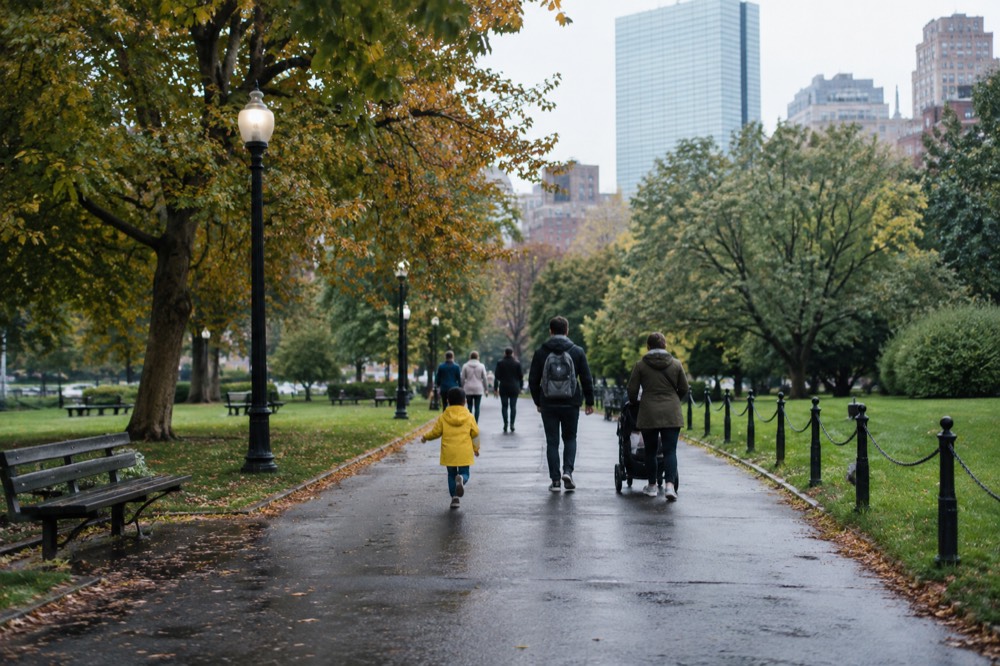
For families, walkability is one of Boston's best cards. The distances in the neighborhood table above are short enough for school-age kids, the itineraries built for families assume walking as the default, and the free sites on the Freedom Trail make a walk-and-stop day cheap as well as easy. The New England Aquarium, right on the downtown waterfront, sits within a short walk of Faneuil Hall, which turns a museum morning and a market lunch into a single walking block.
For paid attractions alongside walking, compare the actual pass menu with individual admission and free eligibility. CityPASS offers four of seven participating choices, and no single savings figure applies to every party. A pass does not establish that each venue is accessible for your needs.
What Should A Walking Day In Boston Actually Look Like?
A realistic walking day pairs one dense neighborhood with one long leg, not both at once: downtown and the North End in a morning, the Esplanade or the Greenway in the afternoon, and the MBTA for anything beyond the peninsula. Visitors who try to walk Cambridge, Charlestown and downtown in one day end up remembering only their feet. The city rewards depth over distance, and the transit system exists precisely so you do not have to earn every block.
A pattern that works, drawn from the verified distances above: start on Boston Common, follow the red line through downtown to Faneuil Hall, lunch in the North End, then choose one afternoon leg, either the Esplanade and a bridge into Cambridge, or the Harborwalk toward the Seaport. That is a full day of walking with the city's two best food stops built in, and the best restaurants guide and lobster roll roundup cover where to break the walk.
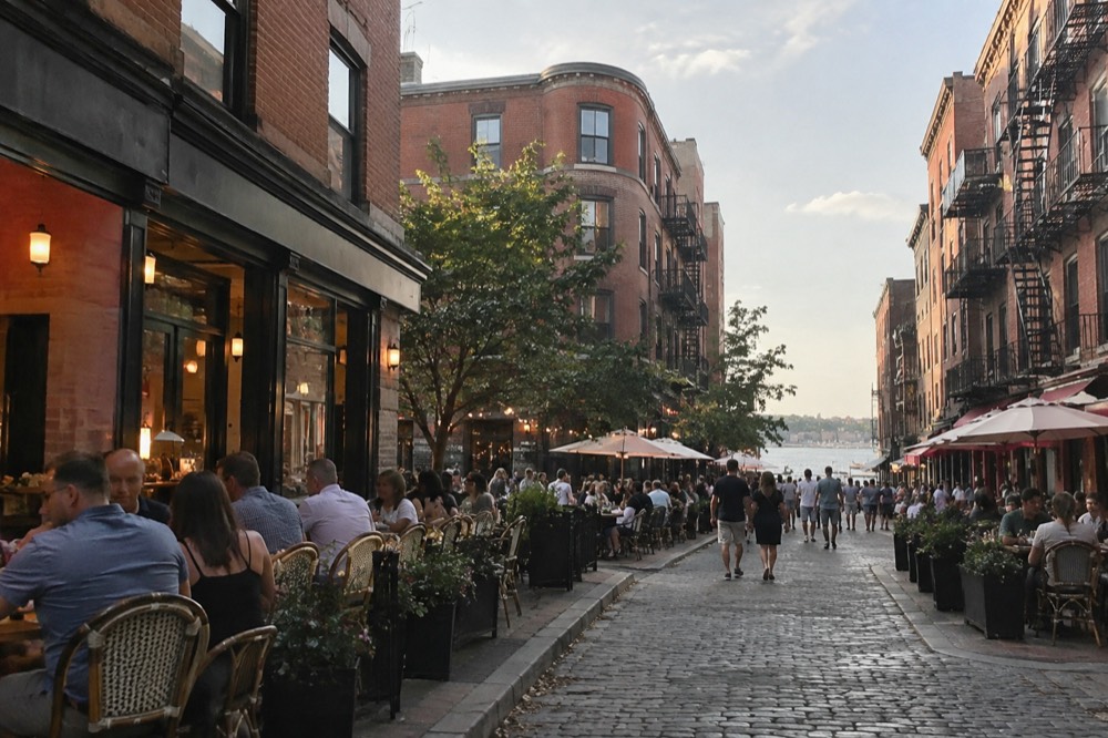
The roughly two-hour North End tasting walk covers about two kilometers, with advance dietary notice required. It offers interpretation and tastings, not a necessary ticket to the neighborhood. A Duck Tour is a separate eighty-minute city-and-Charles overview operated from three boarding locations by one company; it does not stop for walking visits.
Allow for brick, uneven paving, hills and crossings. Winter ice and summer heat can change the walk; July’s average high is not a maximum temperature. Check the current forecast, plan breaks and retain a transit alternative that fits your access needs.
Common Questions About Walking In Boston
is boston walkable
Yes. Boston's downtown core is compact, historic and built around a 2.5-mile walking route, the Freedom Trail, and most visitor neighborhoods sit within a half-hour walk of one another. Only Cambridge, Charlestown and the harbor islands regularly require transit or a ferry.
Can you walk everywhere in Boston?
You can walk the entire downtown peninsula, the North End, Beacon Hill, Back Bay, the Seaport and the Esplanade without transit. Cambridge is a long but pleasant walk across the river, and offshore islands such as Georges and Spectacle need water transport, while mainland-connected park areas such as Deer and Nut islands have land access.
Is Boston good for walking vacations?
It is one of the better US cities for one. The Freedom Trail alone offers 16 sites across 2.5 miles with free public walking and separately ticketed interiors, and the MBTA's $2.40 subway fare with two-hour unlimited transfers under the 2026 pilot rules means transit backup is cheap when legs run out.
Do I need a car when visiting Boston?
No. Parking downtown is scarce and expensive, the Silver Line SL1 from Logan's terminal curb to South Station is free, and subway and bus routes serve many longer journeys, though no network covers every destination or access need. A car only earns its cost on out-of-city day trips, and even those are largely covered by commuter rail and ferry.
What is the best walking route in Boston?
The Freedom Trail: 2.5 miles of red line from Boston Common through downtown and the North End to Charlestown, linking 16 historic sites, with free public walking and separate interior admission rules. It is the route the city was, in effect, designed around, and it passes within a few blocks of most of downtown's food and lodging.
Is Boston walkable in winter?
Walkable, yes, but demanding. NOAA normals show 49.2 inches of snow a year with 58% of it falling in January and February, and January's average high is 36.8 °F. Actual sidewalk clearance and ice vary, but cobblestone plus ice rewards serious footwear, and shorter daylight argues for one dense neighborhood per day rather than a full crossing.
Choose The Route And Walking Commitment
These options do not match your choice. Adjust the selection or reset to explore the starting recommendation.
Freedom Trail Small-Group Walk
A guided walk exploring the Revolutionary history along the Freedom Trail. The trail can also be walked independently. Review the meeting point and route before booking.
A starting option to explore. Choose dates, travelers and the exact booking option with the provider; availability and eligibility are confirmed there.
Check Freedom Trail walk dates