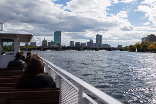
Charles River Esplanade
The Charles River Esplanade is a free public park, roughly three miles long, running along the Boston side of the Charles River from the Boston Museum of Science area upstream to the Boston University Bridge. Park hours are dawn to dusk, except for walk-through traffic and permitted events. The park is a chain of landscaped lawns, lagoons, small islands, boat docks and paved paths, with the Massachusetts State House and Beacon Hill sitting a few blocks uphill from almost any point on it. The view across the water, with Harvard's and MIT's boathouses and the Cambridge skyline on the far bank, is the single most photographed river panorama in the city, and unlike most of Boston's headline attractions it costs nothing at all.
Short answer
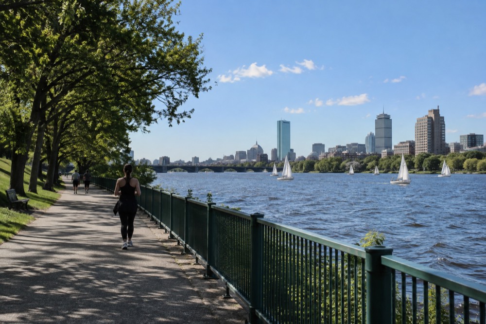
The Charles River Esplanade is a roughly three-mile linear park on the Boston side of the Charles River, built on reclaimed land between the water and Storrow Drive, stretching from near the Museum of Science upstream to the Boston University Bridge. It is public parkland, free to enter, open dawn to dusk except for walk-through traffic and permitted events, and it carries the Hatch Shell concert stage, several lagoons and small islands, community boating docks, playgrounds and miles of walking and running paths.
The Charles River Esplanade is a free public park, roughly three miles long, running along the Boston side of the Charles River from the Boston Museum of Science area upstream to the Boston University Bridge. Park hours are dawn to dusk, except for walk-through traffic and permitted events. The park is a chain of landscaped lawns, lagoons, small islands, boat docks and paved paths, with the Massachusetts State House and Beacon Hill sitting a few blocks uphill from almost any point on it. The view across the water, with Harvard's and MIT's boathouses and the Cambridge skyline on the far bank, is the single most photographed river panorama in the city, and unlike most of Boston's headline attractions it costs nothing at all.
The Esplanade walk is free. Want to see its lawns and the Boston skyline from the water? Explore the Charles River cruise, boarding behind CambridgeSide in Cambridge; allow time to cross the river to its dock. Check Charles River cruise departures
This page from Boston Travel Guide covers what the Esplanade actually is, what there is to do on it, how the MBTA gets you there, what the river tours cost, and the seasonal traps most visitors fall into, including the Swan Boats closure that catches out a surprising number of autumn travelers.
What Is The Charles River Esplanade?
The Charles River Esplanade is a roughly three-mile linear park on the Boston side of the Charles River, built on reclaimed land between the water and Storrow Drive, stretching from near the Museum of Science upstream to the Boston University Bridge. It is public parkland, free to enter, open dawn to dusk except for walk-through traffic and permitted events, and it carries the Hatch Shell concert stage, several lagoons and small islands, community boating docks, playgrounds and miles of walking and running paths. The park exists because of damming and landfill projects that reshaped the Charles starting in the early twentieth century, when the river's tidal mudflats were transformed into the basin you see today. What was once a smelly tidal flat became one of the most valuable open spaces in the city.
The park's structure matters for planning a visit. It sits below street level, separated from Back Bay and Beacon Hill by Storrow Drive, and you reach it through a series of footbridges and underpasses. The most useful crossings for visitors are the ones near Arlington Street, the Footbridge at Dartmouth, and the pedestrian overpass by the Hatch Shell. Once you are down on the paths, the traffic noise drops noticeably and the scale of the place opens up.
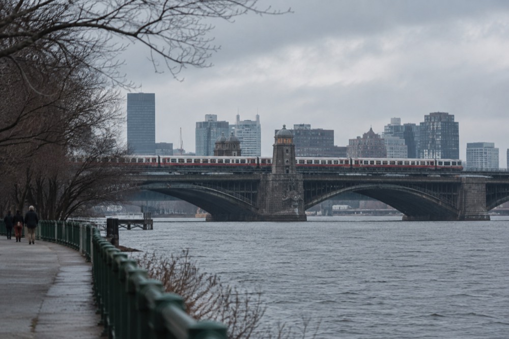
The far bank is Cambridge, not Boston. That distinction trips up a lot of first-time visitors, because the postcard view of the Boston skyline is photographed from the Cambridge side, while the postcard view of Cambridge's boathouses and towers is photographed from the Esplanade itself. If you want the classic skyline shot, walk over one of the bridges to the Cambridge side and look back.
What Can You Do On The Esplanade In Boston?
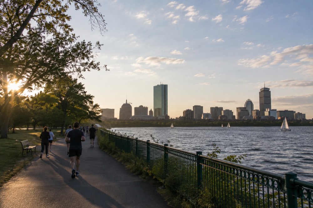
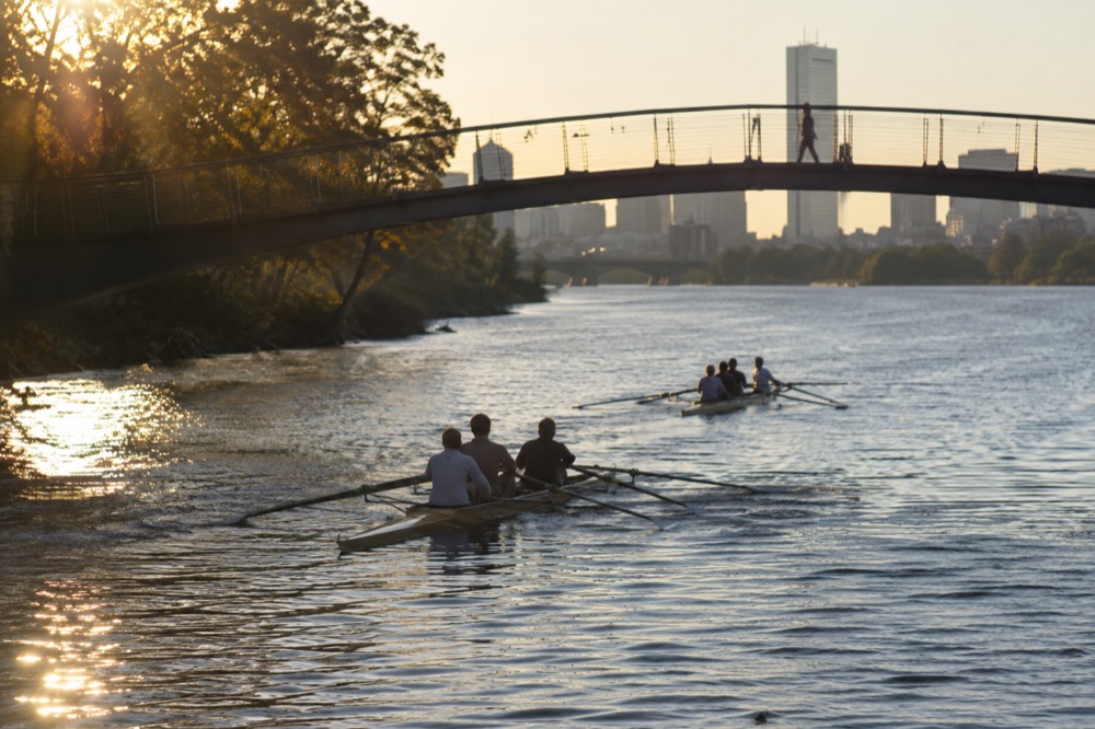
The Esplanade's main draws are walking and running its paths, watching the sailing on the river basin, free summer concerts at the Hatch Shell, kayaking and community boating from its docks, picnicking on the lawns, and photographing the skyline from the footbridges. The park is free and normally open dawn to dusk. Its eastern stretch is near the Museum of Science, Beacon Hill and the Public Garden; the western end reaches the Boston University Bridge. For most visitors the park works as a two-hour stroll, a morning run, or the scenic route between two bigger sights rather than a destination with a ticket booth and a schedule.
The Hatch Shell is the park's architectural centerpiece, an open-air bandshell on the riverbank that hosts free performances through the warm months. Its most famous event is the Boston Pops July Fourth concert and fireworks, which draws enormous crowds; the Esplanade fills up from early morning on the day itself and the event is covered in detail on our 4th of July in Boston planning pages. Note that the Boston Pops and Symphony Hall performances themselves are not something this site sells tickets for, and the Hatch Shell's free summer programming is exactly that, free.
Community boating provides a separate way to use the river, with its own rental or membership terms, eligibility and seasonal schedule. Check the relevant boathouse’s current program before arriving; a sightseeing cruise booking does not include a kayak or sailing rental.
For visitors who want the river without the effort of paddling, the sightseeing options are strong. The Charles River Sightseeing Cruise runs about an hour and ten minutes on the basin, and its listing shows it from $32 per person with a 4.7 rating across 198 reviews. The duck boats splash down into the Charles from a city route, and the Freedom Trail walking tours cover the historic sights a short walk uphill from the park. The table below compares the three most relevant options.
| Experience | Duration | From (per person) | Rating | What You Get |
|---|---|---|---|---|
| Charles River Sightseeing Cruise | 1 hour 10 minutes | $32 | 4.7 from 198 reviews | Narrated loop on the river basin |
| Boston Duck Boat Sightseeing City Tour with Cruise | 1 hour 20 minutes | $62 | 4.6 from 10,003 reviews | City streets plus a river splashdown |
| Freedom Trail History Small Group Walking Tour | 2 hours 30 minutes | $39 | 4.9 from 7,835 reviews | Guided walk of the Revolution sites |
| Classic Tall Ship Cruise in Boston Harbor | 1.5 to 2 hours | $40 | 4.7 from 792 reviews | Sailing, but on the harbor rather than the river |
A walking visit pairs naturally with the neighborhoods above the park. Beacon Hill sits closest to the downstream half, and Back Bay rises behind the upstream half, with Newbury Street a few blocks from the Dartmouth footbridge. The Boston Public Library in Copley Square is a short walk from the same crossing.
To see the city from a fresh angle, book a bicycle tour here.
How Do You Get To The Esplanade By MBTA?
The fastest MBTA access points are Charles/MGH on the Red Line at the downstream end, Hynes Convention Center on the Green Line for the Back Bay stretch, and Science Park or Green Line stops at the Museum of Science end, with a subway fare of $2.40 each way. Since September 1, 2026, one fare includes unlimited transfers between subway, bus and ferry within a two-hour window, paying only the highest-priced leg, so a journey that combines lines costs no more than its most expensive segment. That transfer rule is new and it makes multi-line journeys across Boston materially cheaper than they were before.
The MBTA's fare table shows a 1-Day Pass at $11.00 and a 7-Day Pass at $22.50, both valid for unlimited travel. There is a subtlety worth knowing: a pass loaded on a CharlieTicket starts at the date and time of purchase, while the same pass on a CharlieCard starts at its first use. If you buy on arrival day and start sightseeing the next morning, the CharlieCard version preserves most of a day of validity. Contactless Tap to Ride with a card or phone also works across bus, subway and ferry, and the MBTA publishes the details on its fares page.
One caveat for Green Line riders: Symphony station on the E branch has been closed since June 2026 for accessibility work, with closure scheduled through spring 2029, and there have been rolling weekend diversions on several lines through September and October 2026. Check service alerts on the day you travel. The table below maps the most useful stations to the parts of the park.
| Station | Line | Nearest Part of the Esplanade |
|---|---|---|
| Charles/MGH | Red | Longfellow Bridge, Hatch Shell area |
| Hynes Convention Center | Green B, C, D | Dartmouth footbridge, Back Bay lawns |
| Arlington | Green B, C, D, E | Arlington Street entrance, Public Garden end |
| Science Park | Green D, E | Museum of Science end of the park |
| Kenmore | Green B, C, D | Upstream end, near the Bowker Overpass area |
Visitors arriving at Logan Airport have a notable freebie: the Silver Line SL1 provides free service from the terminal curb to South Station, as Massport's own transport page states, so the airport-to-downtown leg by public transport can cost nothing at all. From South Station, the Red Line runs three stops to Charles/MGH. Total airport travel time depends on traffic, waits and your walk to the park.
When Is The Best Time Of Year To Visit The Esplanade?
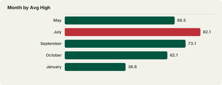
The best months for the Esplanade are May through October, when the lawns are green, the sailing fleet is on the water and the Hatch Shell hosts free concerts, and the warm-season average highs run from 66.5°F in May to 82.1°F in July, the warmest month, easing back to 62.1°F by October. Boston has no wet or dry season, with every month's precipitation between 3.21 and 4.30 inches, so rain planning matters more than rain avoidance. The NOAA climate normals for the Boston station, measured at Logan Airport on the harbor peninsula, show a remarkably even rainfall spread across the year.
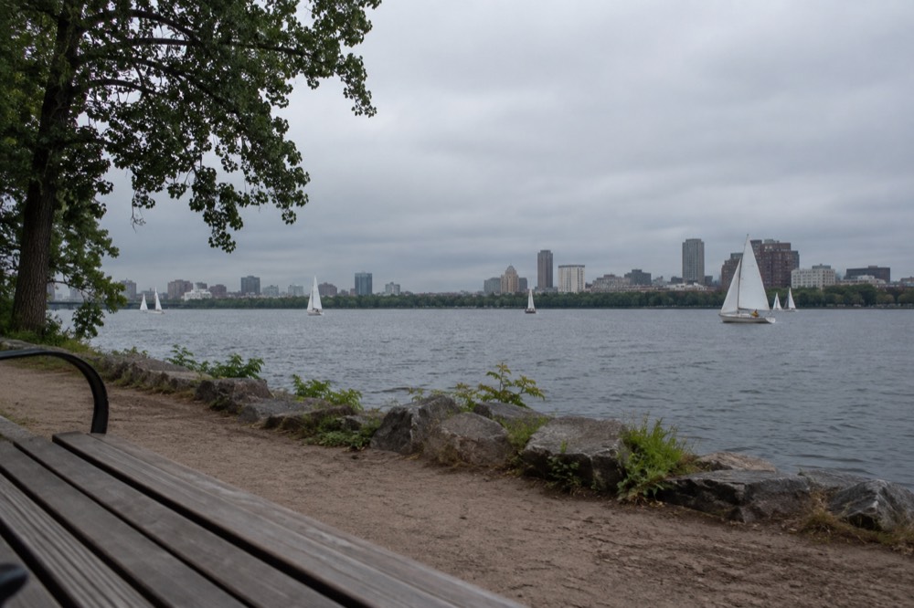
July and August are the busiest months on the paths, especially around the Hatch Shell on concert evenings. May, June and September offer the same views with thinner crowds, and September in particular combines warm water temperatures with the start of the fall color further inland. Winter strips the park back to its bones: the paths stay open, runners use them year-round, and the basin often freezes over, which is a striking sight from the Longfellow Bridge even if it is not a swimming one.
Snow is the one genuinely seasonal weather factor. The NOAA normals put annual snowfall at 49.2 inches, and 28.7 inches of that, about 58%, falls in January and February alone. A winter visit is perfectly pleasant on a clear day, but the lawns are out of play and the docks are closed.
| Month | Avg High | Avg Low | Precip (in) | Esplanade Character |
|---|---|---|---|---|
| May | 66.5 | 50.3 | 3.25 | Sailing season starts, lawns reopen |
| July | 82.1 | 66.0 | 3.27 | Peak season, Pops and crowds |
| September | 73.1 | 58.2 | 3.56 | Warm water, thinner crowds |
| October | 62.1 | 47.5 | 4.03 | Fall color, quieter paths |
| January | 36.8 | 23.1 | 3.39 | Check ice and path conditions; walking and running when suitable |
Check a dated Duck Tour departure before building your day around the splashdown. The usual season runs from April through the Sunday after Thanksgiving; choose the actual departure point and allow time to reach it from the park. Check Duck Tour dates
What Is There To See Near The Esplanade?
Within a fifteen-minute walk of the Esplanade you can reach the Boston Public Garden, the start of the Freedom Trail's downtown stretch, the Museum of Science at the park's downstream end, Beacon Hill's Acorn Street, the Massachusetts State House and the Back Bay shopping streets, making the park one of the best-connected stretches of open space in the city for sightseeing on foot. The park functions as a scenic corridor between several of Boston's headline sights, and most visitors end up walking at least part of it whether they planned to or not.
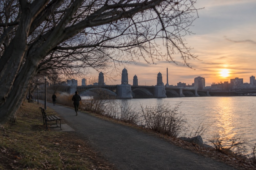
The Common and Public Garden lie inland from the eastern Esplanade, requiring a street walk after the footbridge. The Freedom Trail begins at the Common; it does not run along the riverbank. Free sites include Bunker Hill and the Navy-operated USS Constitution, subject to access hours and conditions.
One seasonal warning belongs here because the Public Garden is the natural next stop: the Swan Boats are closed for the season, and their own site states they will not run again until April 2027. Any guide telling you to ride them this autumn or winter is out of date. The Public Garden itself remains open and free year-round.
At the downstream end, the Museum of Science anchors the park. Check its current admission and exhibit notices; the new Public Science Common is targeted for late 2026. The museum participates in CityPASS, which lets you choose four of seven attractions over nine consecutive days starting with first use. Compare the visits you actually want and any direct-ticket discounts.
What River Tours And Cruises Run On The Charles?
A narrated Charles River cruise lasts about 70 minutes and boards behind CambridgeSide in Cambridge. Duck Tours combine city streets with a shorter Charles water segment. Harbor cruises use docks farther across downtown, including Long Wharf; they do not leave from the Esplanade. The dam separates the basin from the harbor, while the selected two-hour architecture cruise follows a route through both.
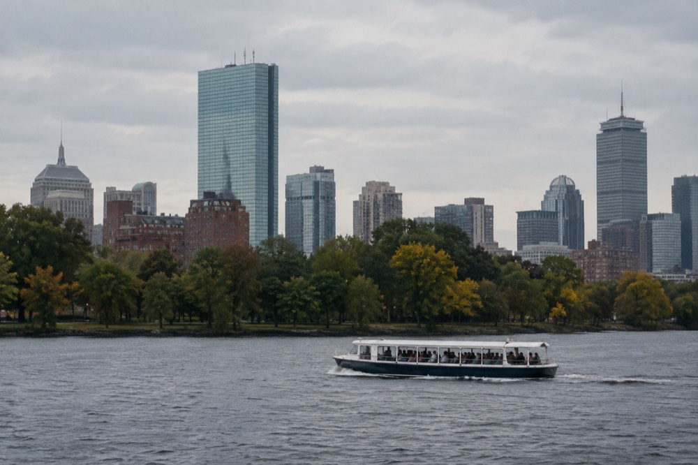
For the Charles sightseeing cruise, allow 70 minutes on the water plus roughly 30 minutes for ticket collection and boarding, as well as the journey to CambridgeSide. Duck Tours use their own three boarding locations and seasonal calendar. Check each operator’s actual dates rather than assuming all river boats end before all harbor boats.
For visitors pairing a river view with history, the walking tours are the stronger fit. The Freedom Trail History Small Group Walking Tour covers the Revolution sites in two and a half hours, and its listing shows 4.9 from 7,835 reviews, one of the highest-rated history products in the city. A free option also exists: the Highlights of Boston free tour on GuruWalk, led by a local guru, is tip-based and runs about two and a half hours, though it covers the downtown core rather than the riverbank.
Want architectural context beyond the skyline photograph? Explore the two-hour cruise that combines the Charles River and harbor. It boards behind CambridgeSide, includes narration rather than building entry, and returns to its starting dock. Check architecture cruise dates
What Should You Know Before You Go?
Bring water and sunscreen in summer because the paths are largely unshaded at midday, expect the lawns to fill early on Hatch Shell concert days, know that the park is free and normally open dawn to dusk, and plan your crossing points in advance because Storrow Drive separates the park from the city above it at every point except the footbridges. There is no park admission ticket. Hours are dawn to dusk, except for walk-through traffic and permitted events.
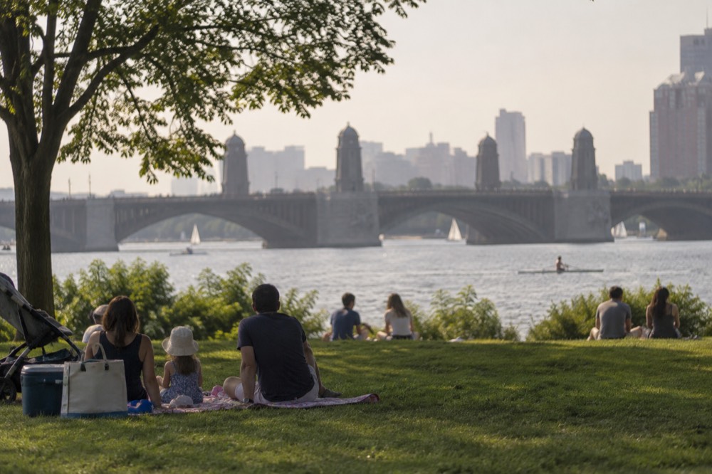
Restroom availability varies by location and season, so check facilities before a long walk. The Charles basin above the dam is controlled and does not rise and fall with Boston Harbor’s roughly 9.49-foot mean tidal range. Harbor tide predictions are not an Esplanade water-level forecast.
Further reading: NOAA station page.
For a fuller rundown of the city's headline sights, our main things to do in Boston page places the Esplanade in context, and the Faneuil Hall and Quincy Market guide covers the market halls at the far end of a riverside-to-waterfront walking day.
Common Questions About The Charles River Esplanade
Is the Charles River Esplanade free?
Yes. The Esplanade is free public parkland, normally open dawn to dusk except for walk-through traffic and permitted events. Everything on the paths, lawns and footbridges is free, including the Hatch Shell's summer concert programming. Only the on-water activities cost money: community boating from the docks and the commercial sightseeing cruises.
How long is the Charles River Esplanade?
Roughly three miles along the Boston side of the Charles, running from the Museum of Science area upstream to the Boston University Bridge. Most visitors walk only a segment, commonly the stretch between the Longfellow Bridge and the Dartmouth footbridge, which covers the best skyline and river views in about an hour at a relaxed pace.
Can you swim in the Charles River at the Esplanade?
No, swimming is not part of the Esplanade's normal use. The river basin is a controlled body of water used for sailing, rowing and kayaking, and the park's lawns and docks are built for watching the water rather than entering it. Community boating outfits offer kayaking and sailing in the warm season, which is the sanctioned way onto the river.
What is the Hatch Shell?
An outdoor performance venue on the Esplanade, known for the Boston Pops July Fourth event and other seasonal programs. Check the actual dated calendar, event access rules and weather notices rather than assuming a performance every evening.
Is the Charles River Esplanade open in winter?
The park remains a year-round destination, normally dawn to dusk except for walk-through traffic and permitted events. Check temporary closures, snow and ice conditions; frozen-looking water is not safe to enter. Boating and events follow their own seasonal schedules.
Is the Charles River Esplanade the same as the Cambridge side?
No. The Esplanade is specifically the park on the Boston side of the river. Cambridge, on the far bank, is a separate city with its own riverfront paths, and the classic skyline photographs of Boston are taken from the Cambridge side looking back. Walk over the Longfellow or Harvard Bridge for a view back toward Boston.
Choose Your Charles River Outing
These options do not match your choice. Adjust the selection or reset to explore the starting recommendation.
Compare Your River Outing Totals
Reader-entered estimates in USD, not live quotes. Use the same dates and travelers for both options. Include all relevant tickets, rooms, taxes, mandatory fees and transport for the entire trip once in each total. Do not add a transfer twice if your rate already includes it.
Charles River Skyline Cruise
A 70-minute narrated river cruise departing behind CambridgeSide, 100 Cambridgeside Place in Cambridge. Collect boarding passes at the ticket booth about 30 minutes early. Return to the same dock. Food, drinks and transport to the dock are not included. This does not depart from the Esplanade or Long Wharf.
A starting option to explore. Choose dates, travelers and the exact booking option with the provider; availability and eligibility are confirmed there.
Check Charles River cruise departures