Beacon Hill
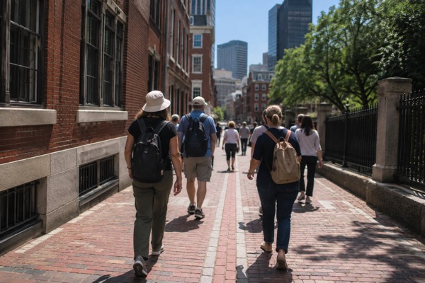
Beacon Hill is roughly 60 acres of brick and slate on the slope above the Boston Common, and the neighborhood's look is protected by law: the Beacon Hill Historic District, one of the first designated in an American city, restricts what owners can change about the facades, which is why the streetscapes still read as the early nineteenth century. The Boston Travel Guide desk covers it here as a practical walking area, because that is what it is. Everything below, from the Freedom Trail sites to the Charles Street shops, sits within a 15-minute walk of the State House steps.
Short answer
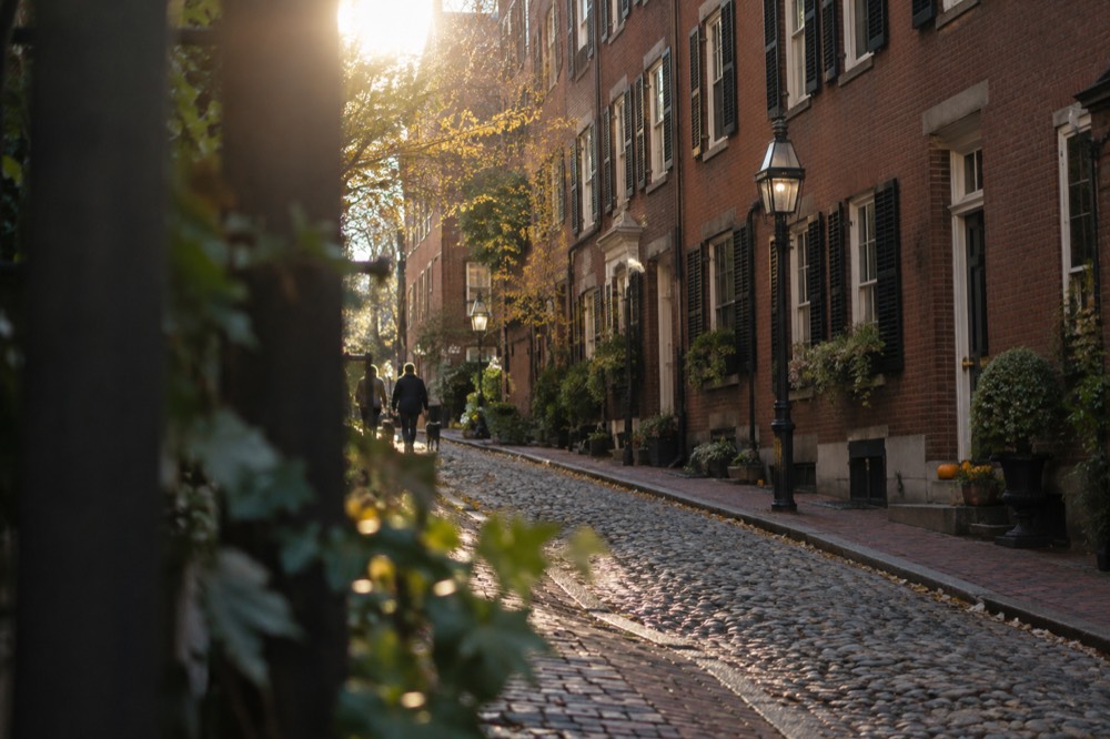
Beacon Hill is known for its intact Federal-style brick row houses, its gas lamps and cobblestone lanes, and for carrying the Massachusetts State House plus a run of Freedom Trail sites on and around its slopes. It is also the historic home of Boston's Black community on the north slope, and its streets appear in more photographs of Boston than almost any other neighborhood.
Beacon Hill is roughly 60 acres of brick and slate on the slope above the Boston Common, and the neighborhood's look is protected by law: the Beacon Hill Historic District, one of the first designated in an American city, restricts what owners can change about the facades, which is why the streetscapes still read as the early nineteenth century. The Boston Travel Guide desk covers it here as a practical walking area, because that is what it is. Everything below, from the Freedom Trail sites to the Charles Street shops, sits within a 15-minute walk of the State House steps.
Want a guided walk that actually includes Beacon Hill? The food-and-history route links it with the Freedom Trail and North End tastings; leave time for approximately five miles of walking. Check food and history walk dates
Beacon Hill’s south slope rises above the Common, while its north slope holds important Black history sites. Charles Street runs along the western base between Beacon and Cambridge streets; it is not the flat north side. Acorn Street and Louisburg Square include private residential spaces, so observe signs and keep entrances clear.
Further reading: Massachusetts State House.
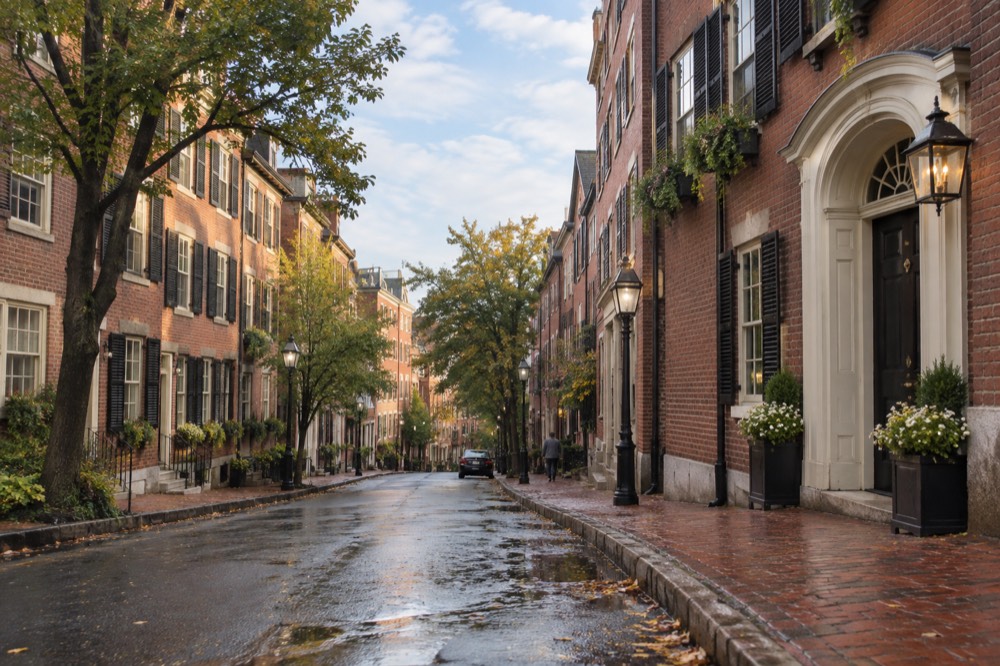
The hill's name is literal. The original beacon on the summit was a warning post from the colonial era, and when the State House rose on the ridge, the neighborhood around it became the address Boston's merchant elite competed for. That competition produced the architecture: brick laid to strict rules, doors painted in a narrow palette, and iron railings that have been re-cast rather than replaced. Walking it today, you are seeing the result of two centuries of owners being told what they may not change.
What Is Beacon Hill Known For?
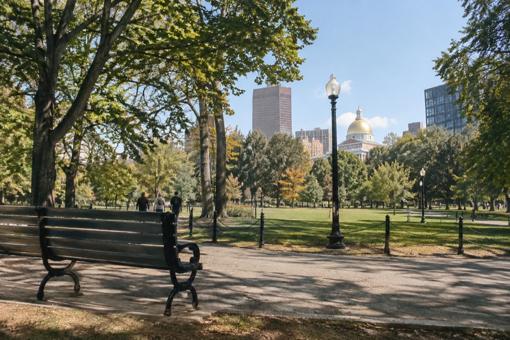
Beacon Hill is known for its intact Federal-style brick row houses, its gas lamps and cobblestone lanes, and for carrying the Massachusetts State House plus a run of Freedom Trail sites on and around its slopes. It is also the historic home of Boston's Black community on the north slope, and its streets appear in more photographs of Boston than almost any other neighborhood. The gold-domed State House at the top of the hill, designed by Charles Bulfinch, anchors the whole district, and the red line of the Freedom Trail passes the Common's edge before climbing toward the sites beyond.
Historic-district rules protect the neighborhood’s external appearance, but they do not mean every brick is original or that all chain businesses and modern alterations are prohibited. The streetscape reflects preservation alongside changes over time.
The north slope carries a second history that most visitors miss entirely. Before the Civil War, this side of the hill was home to a substantial free Black community, and the Museum of African American History on Joy Street, together with the Black Heritage Trail that links sites around it, documents that story. The museum's African Meeting House is the oldest surviving Black church building in the United States, and the National Park Service offers ranger-led Black Heritage Trail walks that start near the Common and end at the meeting house.
How Do You Spend A Day In Beacon Hill?
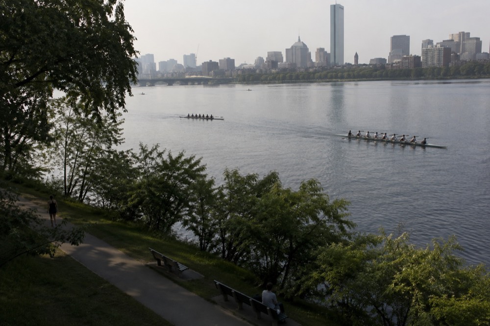
A full day splits cleanly into a loop: start at the State House on Beacon Street, walk the south slope lanes to Louisburg Square and Acorn Street, descend to Charles Street for lunch and shopping, then cross to the Esplanade along the Charles River before looping back through the north slope and the Museum of African American History. The whole circuit is about two miles of walking, mostly on brick and cobblestone, so wear real shoes and expect short steep sections.
A half-day version works just as well and is what most visitors actually do. The State House steps, Acorn Street, and Charles Street between Cambridge and Revere streets cover the essential neighborhood in about two hours at a photo-taking pace. If you are folding Beacon Hill into a bigger day, the natural pairing is the Boston Common and Public Garden first, then the hill, then a descent into downtown toward Faneuil Hall, which keeps you on the Freedom Trail's own line.
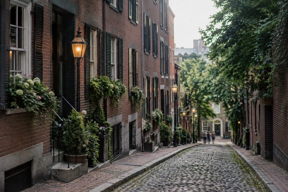
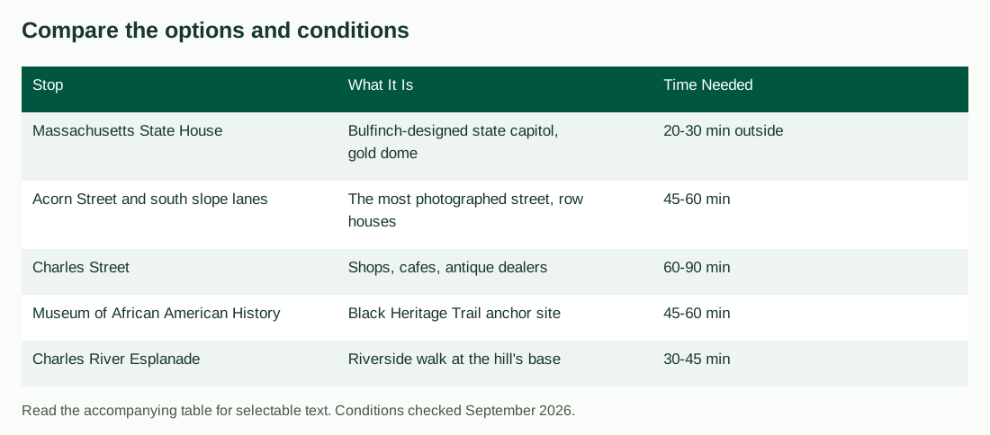
A reasonable day plan, in order:
| Stop | What It Is | Time Needed |
|---|---|---|
| Massachusetts State House | Bulfinch-designed state capitol, gold dome | 20-30 min outside |
| Acorn Street and south slope lanes | The most photographed street, row houses | 45-60 min |
| Charles Street | Shops, cafes, antique dealers | 60-90 min |
| Museum of African American History | Black Heritage Trail anchor site | 45-60 min |
| Charles River Esplanade | Riverside walk at the hill's base | 30-45 min |
Two practical notes on the loop. The hill's steep middle means the direction you walk matters: descending from the State House to Charles Street is gentle, while climbing from Charles Street back up to Louisburg Square is a real hill on brick sidewalks, so save the uphill legs for when you have energy left. And the antique dealers on Charles Street close early in the week, often by mid-afternoon, so if browsing them is a priority, do that before the cafe stop, not after.
If the day is your first in the city, read our overview of things to do in Boston first, because Beacon Hill pairs naturally with downtown and the North End, and a good itinerary treats them as one walk.
Which Freedom Trail Sites Sit On Or Near Beacon Hill?
The Freedom Trail's red line touches Beacon Hill at the Boston Common and the State House's edge, then runs downhill toward downtown, but the trail's paid sites cluster just beyond the neighborhood in downtown and the North End. Of the 16 official sites, only four charge admission anywhere along the route, and the free ones near Beacon Hill include Faneuil Hall and the Park Street Church area sites. The trail itself is 2.5 miles long, per the Freedom Trail Foundation's own visit page, and the segment from the Common through downtown takes about an hour on foot without stops.
The National Park Service publishes the authoritative fee table, and it is the one most guides blur. Here is the part that matters for a Beacon Hill visitor walking downhill into downtown:
| Site | Admission and access |
|---|---|
| Old State/Old South | $18 combined adult, $16 senior, $10 ages 6–17; under 6 free |
| Paul Revere House | Separate current admission and hours |
| Old North Church | General admission and additional tours differ |
| Faneuil Hall | Free public hall when open |
| USS Constitution | Free Navy ship; security and adult ID requirements |
Check each operator’s current admission and hours rather than relying on an older aggregated fee table. The Old State/Old South combined ticket covers both buildings; do not buy the same admission twice.
Further reading: National Park Service's Boston National Historical Park page.
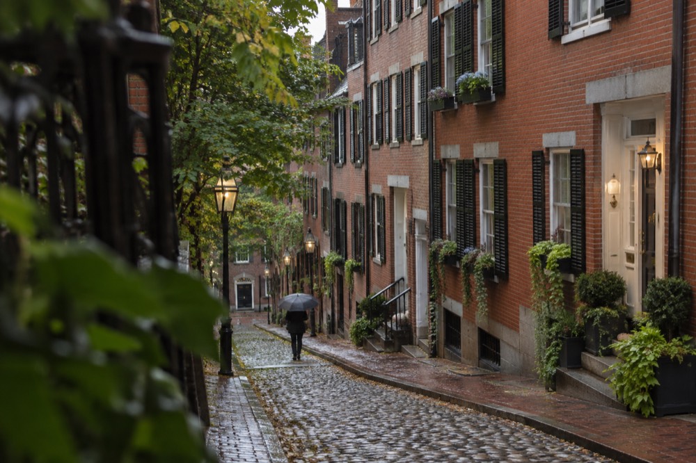
If you want a guide rather than a self-directed walk, the small-group Freedom Trail option is the one that tracks this route most closely.
Want a shorter guided focus on Revolutionary history? Explore the Common-to-North End walk, with historic interiors and the Black Heritage Trail as separate visits. Check Freedom Trail walk dates
Is Beacon Hill Worth Visiting, And When?
Beacon Hill suits visitors interested in architecture, Black history and neighborhood walks. Public streets are free to explore, but private lanes, gardens and interiors have their own access conditions. Early morning or late afternoon can offer different light; neither guarantees empty streets or unrestricted access.
Season matters less here than you might think. NOAA's 1991-2020 climate normals for Boston show no wet or dry season at all: every month of the year averages between 3.21 and 4.30 inches of precipitation, so there is no month to avoid for rain and no month to chase. What does change is the feel. Snow transforms the hill, and Boston averages 49.2 inches of it a year, with 58% of that falling in January and February alone, which makes a snowy morning on Acorn Street a genuine if weather-dependent payoff.
Where Do You Eat On Beacon Hill?
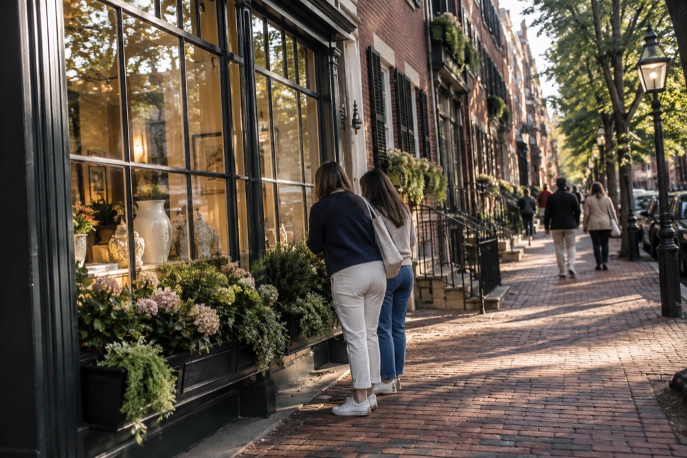
Charles Street is the eating spine of Beacon Hill, running about six blocks of restaurants, cafes, a famous old tavern and some of the city's best-known brunch spots, plus an old-school Italian grocer and an ice cream shop that draws lines in summer. The hill itself has few restaurants off Charles Street, so plan meals on that one street or walk five minutes downhill to downtown or Cambridge Street for more options. Reservations matter on weekends, when the brunch trade fills every table.
The neighborhood's food identity is small and polished rather than sprawling. You will not find a food hall here; you will find single-concept rooms in low brick storefronts, many of them decades old. For a deeper food experience, the North End's Italian scene is a 15-minute walk away, and our North End neighborhood guide covers where the bakeries and cannoli shops cluster.
A quick orientation to the eating options, by block:
| Part of Charles Street | What You Find | Good For |
|---|---|---|
| Beacon to Mt Vernon streets | Tavern, cafes, brunch spots | Weekend breakfast, historic interiors |
| Mt Vernon to Chestnut streets | Italian grocer, ice cream, casual lunch | Snacking, picnic supplies |
| Chestnut to Cambridge streets | Sit-down dinner restaurants | Evening meals, date nights |
If eating your way through several neighborhoods in one guided walk appeals, the food-and-history combination tour below spends five hours across Beacon Hill, the North End and the Freedom Trail, and its listing shows a 4.9 rating from 1,888 reviews.
For an evening of darker storytelling after the walk, book a ghosts and gravestones trolley tour here.
How Do You Get To Beacon Hill?
Charles/MGH on the Red Line serves the western base of Beacon Hill, while Park Street on both Red and Green lines serves the Common below the State House. Charles/MGH is an elevated station near the hospital, not underneath it. Expect uphill sections on routes from either station and choose passes by actual travel needs.
One fare detail from the MBTA's own pages that changed on 1 September 2026: riders can now make unlimited transfers between subway, bus and ferry within a two-hour window and pay only the highest-priced leg, provided the same payment method is used across all legs. That makes a multi-stop day cheaper than the arithmetic suggests. The full rules are on the MBTA fares page.
| Option | Cost | Notes |
|---|---|---|
| Red Line to Charles/MGH | $2.40 one-way | Arrives at the hill's base, next to MGH |
| Green Line to Park Street | $2.40 one-way | Arrives at the Common, the hill's top |
| 1-Day pass | $11.00 | Unlimited rides, 24 hours |
| 7-Day pass | $22.50 | Unlimited rides, 7 days |
| On foot from downtown | Free | 10 minutes from Government Center area |
Driving is the wrong answer here. The streets are narrow, resident permit parking dominates, and meters on Charles Street fill early. Our getting around Boston advice covers the transit picture citywide, and the honest summary for this neighborhood is: walk or ride the T.
What Are The Best Photo Spots In Beacon Hill?
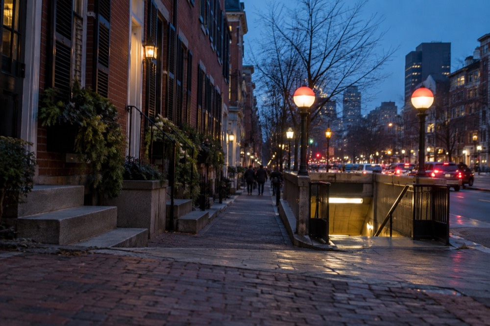
Consider views of the State House from the Common, residential facades on public streets and the edge of Louisburg Square. Acorn Street is privately owned and Louisburg Square’s central garden is private. Respect signs and resident access; no time of day guarantees an empty lane or permission for a formal shoot.
At Acorn Street, observe posted restrictions, avoid blocking doorways and do not assume access for organized or commercial photography. Our Boston photography spots guide covers other viewpoints; public streets provide alternatives when a private location is restricted.
Where Should You Stay Near Beacon Hill?
Beacon Hill itself offers very little lodging: a small number of historic inns and one or two boutique properties, with the bulk of the neighborhood's real estate protected residential brick. Most visitors who want to stay in the area book in adjacent downtown, the waterfront, or Back Bay, all within a 10-15 minute walk, and the trade-off is straightforward: rooms near the hill cost a premium for location, not for space. Staying here means waking up on the Freedom Trail, at hotel prices that reflect it.
For comparing nearby bases, read our Back Bay and downtown and financial district guides. Check the exact property, walking route and room total; proximity alone does not establish that rooms sell out or that every hotel is within 10–15 minutes.
If a harbor view matters more than waking up on the hill, the sightseeing cruise below runs a one-hour narrated loop from Long Wharf, a 15-minute walk from the State House, and its listing shows 4.6 from 1,934 reviews.
Would a Public Garden base suit your visit? Explore The Newbury Boston, an adjacent Back Bay option rather than a hotel on Beacon Hill itself. Check rooms at The Newbury Boston
What Is Near Beacon Hill For The Rest Of Your Trip?
Beacon Hill sits at the center of Boston's walkable core: the Boston Common and Public Garden are on its south edge, downtown and Faneuil Hall are downhill to the east, the Charles River Esplanade is at its base, and the North End is about 15 minutes on foot. Cambridge's Harvard Square is a Red Line ride toward Alewife from Charles/MGH station. Very few visitors need a car for anything within a mile of the hill, and the Freedom Trail's route through downtown means the neighborhood is usually the start of a longer walk rather than a destination on its own.
For planning beyond the hill, the strongest pairings are the Charlestown Navy Yard and Bunker Hill, reached by ferry or a longer walk across the bridge, and Fenway Park, about 30 minutes on foot or a short Green Line ride from Park Street. Both anchor half-days that combine naturally with a Beacon Hill morning.
Common Questions About Beacon Hill
Is Beacon Hill Boston worth visiting?
Yes, for nearly every traveler. It is the city's best-preserved historic neighborhood, it costs nothing to walk, and it sits between the Boston Common and downtown, so it fits into almost any itinerary without detouring.
Can you walk around Beacon Hill for free?
Public streets and nearby parks can be explored free. Acorn Street and the garden at Louisburg Square are private spaces with restrictions, while museums and other interiors have separate entry rules. Check signs and keep residential access clear.
What is the most famous street in Beacon Hill?
Acorn Street, a single cobblestone block on the south slope, is the most photographed street in the neighborhood and one of the most photographed in Boston. Louisburg Square and Mt Vernon Street run it close.
How much time do you need in Beacon Hill?
Two hours covers the essential loop: the State House, Acorn Street and Charles Street. A half-day adds the Museum of African American History and the Esplanade at a relaxed pace.
What subway stop is Beacon Hill?
Charles/MGH on the Red Line is near the western base; Park Street on Red and Green lines serves the Common. Neither removes the uphill walking needed to reach some Beacon Hill streets.
Where do you eat in Beacon Hill?
Charles Street. Nearly all the neighborhood's restaurants, cafes and shops sit on those six blocks, and anything beyond them is a short walk to downtown or Cambridge Street.
Choose How To Explore Beacon Hill
These options do not match your choice. Adjust the selection or reset to explore the starting recommendation.
Boston Food And History Walk
A guided walk linking the North End, Freedom Trail and Beacon Hill, with food stops in the North End. Allow approximately five miles of walking and tell the operator about dietary requests at least 24 hours ahead.
A starting option to explore. Choose dates, travelers and the exact booking option with the provider; availability and eligibility are confirmed there.
Check food and history walk dates