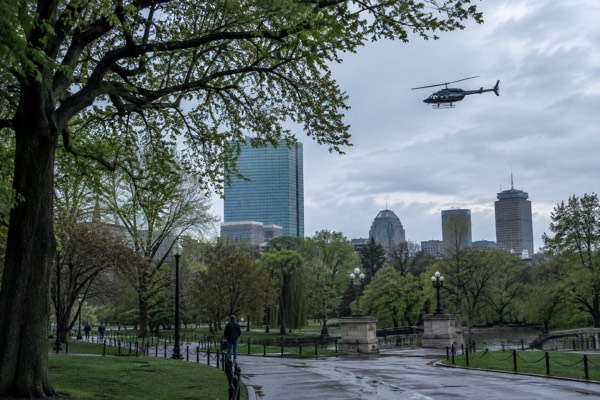
Boston Photography Spots
Boston’s waterfront, historic streets and modern towers offer varied photographic subjects within a compact area. The Freedom Trail connects sixteen historic stops along a 2.5-mile outdoor route. For waterfront compositions, check tide predictions, the forecast and the sun’s direction for your exact date; monthly climate averages do not predict photographic light.
Short answer
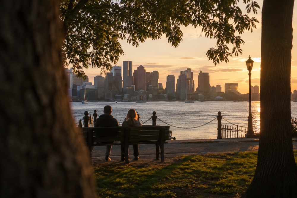
The five locations that produce the most publishable frames are the Charlestown Navy Yard for the USS Constitution against the skyline, Acorn Street in Beacon Hill for the cobblestone close-up, Hanover Street and the surrounding alleys of the North End for old-city texture, the Harborwalk stretch from Long Wharf toward the Seaport for water-and-glass skylines, and the Esplanade along the Charles River for the Back Bay skyline at sunset. Each one rewards a specific hour, and none requires a ticket.
Boston Photography Spots
Boston’s waterfront, historic streets and modern towers offer varied photographic subjects within a compact area. The Freedom Trail connects sixteen historic stops along a 2.5-mile outdoor route. For waterfront compositions, check tide predictions, the forecast and the sun’s direction for your exact date; monthly climate averages do not predict photographic light.
Explore the two-hour Back Bay, Public Garden and Beacon Hill walk with smartphone photo tips. It is a history and architecture outing, not a technical class or private portrait shoot. Reconfirm at least 48 hours ahead and use the Dartmouth Street library meeting point. Check architecture photo-walk dates and meeting point
Where Are The Best Boston Photo Spots In The City?
The five locations that produce the most publishable frames are the Charlestown Navy Yard for the USS Constitution against the skyline, Acorn Street in Beacon Hill for the cobblestone close-up, Hanover Street and the surrounding alleys of the North End for old-city texture, the Harborwalk stretch from Long Wharf toward the Seaport for water-and-glass skylines, and the Esplanade along the Charles River for the Back Bay skyline at sunset. Each one rewards a specific hour, and none requires a ticket.
That list is deliberately compact because Boston's photographic strength is concentration. The National Park Service publishes the Charlestown Navy Yard, the USS Constitution and the USS Cassin Young as free sites when open; Cassin Young is closed in September and October 2026, so the most dramatic ship-in-harbor composition in the city costs nothing to reach. Acorn Street is a single narrow lane, often photographed at dawn before delivery trucks and tour groups fill it, while Hanover Street is at its best in early evening when the North End's restaurant signs start glowing against fading sky.
Tides change the exposed seawall and shoreline around the harbor. Use the NOAA Boston station for the actual prediction and its stated datum. A single negative height is not a universal lowest tide, and tidal harbor conditions do not describe every view along the dammed Charles River.
| Spot | What It Gives a Camera | Best Light | Access Cost |
|---|---|---|---|
| Charlestown Navy Yard | USS Constitution, dry dock, skyline across the water | Morning, ship lit from the east | Free |
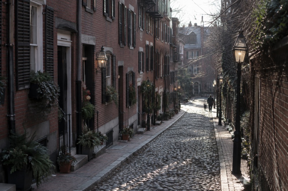
| Acorn Street, Beacon Hill | Cobblestones, brick, gas lamps, Federal-era facades | Early morning before crowds | Free |
| Hanover Street, North End | Dense old-city street life, signs at dusk | Blue hour into evening | Free |
| Harborwalk, Long Wharf to Seaport | Skyline over water, ferries, foreground boats | Golden hour, sunset | Free |
| Charles River Esplanade | Back Bay skyline, sailboats, Hatch Shell | Sunset into blue hour | Free |
For a first visit that mixes all of this, the one day in Boston itinerary strings the waterfront and the Freedom Trail together, and the broader things to do in Boston roundup covers the attractions worth building a shoot around.
Where Can You Photograph The Boston Skyline From?
The best skyline vantage points are on the water, not on land: the harbor cruise routes between Long Wharf and the inner harbor islands give clean unobstructed skyline lines, the Charlestown side of the harbor frames the financial district behind the Navy Yard, and the Cambridge bank of the Charles River puts the Back Bay row, the Prudential Center and the Hancock tower in one vertical stack. From shore, Castle Island in South Boston is the closest free substitute for a boat's angle.
Want to cover more ground between skyline viewpoints? Book a bicycle tour ticket here.
A harbor boat gives moving views of downtown and the Navy Yard, while the Cambridge riverbank offers a different angle on Back Bay. A narrated history cruise and a tall ship sail differ in route, dock and onboard conditions. Neither guarantees unobstructed views, a particular light angle or space for a tripod.
Further reading: Charlestown.
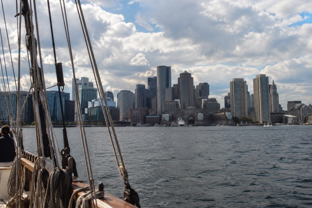
View Boston at the Prudential Center provides elevated views when visibility permits. Clouds, fog and rain can obscure the city, so it is not a reliable bad-weather photography substitute. Check the forecast, dated admission and current camera/equipment rules before planning a shoot; a ticket does not grant commercial filming permission.
A Duck Tour combines streets with a Charles River segment in about 80 minutes. It is a sightseeing ride, not a photography workshop with custom photo stops. The Boston Duck Tours guide explains the three boarding locations, while getting around Boston covers independent travel between viewpoints.
Check visibility before reserving an elevated skyline viewpoint at View Boston. Compare the complete dated ticket and current camera rules; fog can obscure the city, and ordinary admission does not provide commercial filming permission. Check View Boston entry times
What Are The Best Golden Hour And Night Spots In Boston?
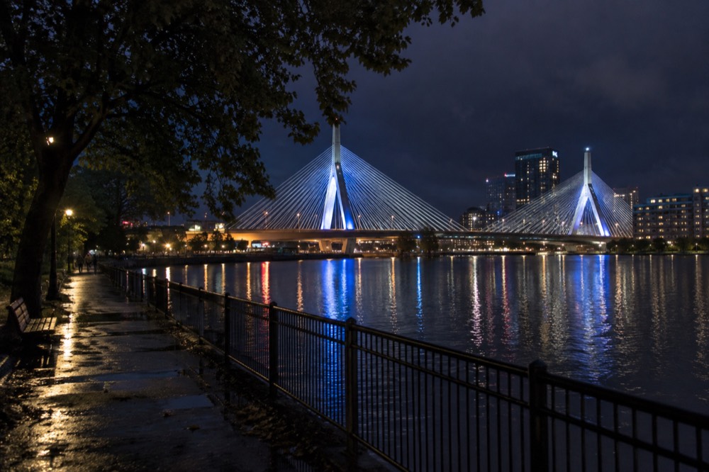
Choose your viewpoint using the sun’s direction and the exact date: the Cambridge riverbank, harborfront and neighborhood streets offer different foregrounds and skyline angles. Night subjects include the Zakim Bridge, Custom House Tower and illuminated Seaport bridges. The sun does not always set behind Back Bay from every point on the Esplanade.
Summer evenings offer later light, but sunset and blue-hour times change across July and depend on the date. Check both the sunset time and the actual cruise departure before combining locations; do not assume you can cover the Esplanade, Beacon Hill and North End without rushing. Other guides are indexed on Boston Travel Guide.
Night photography has one Boston-specific caution: the MBTA's fall 2026 service changes. From September 1, 2026 the MBTA's fare pilot allows unlimited transfers within a two-hour window, paying only the highest-priced leg, which can reduce eligible transfer costs but does not cover a whole evening on one fare. But the transit agency has also scheduled rolling weekend diversions through September and into October, including a full central Green Line suspension on the weekend of September 19-20, 2026, so a night shoot that ends far from a hotel should be planned against the MBTA's own fare and service pages rather than a paper map.
| Time Window | Location | What the Frame Holds |
|---|---|---|
| Sunrise | Castle Island, South Boston | Harbor entrance and fort walls; tide varies independently of sunrise |
| Morning | Charlestown Navy Yard | USS Constitution lit from the east, skyline behind |
| Midday | North End alleys, Beacon Hill | Deep shadow lanes, brick texture, overcast works well |
| Golden hour | Esplanade, Long Wharf | Backlit water, skyline silhouettes |
| Blue hour | Hanover Street, Seaport bridges | Lit signs against cobalt sky |
| Night | Zakim Bridge from Cambridge, Custom House | Long exposures, light trails on the water |
Which Historic Streets And Neighborhoods Photograph Best?
Beacon Hill, the North End and downtown’s Freedom Trail offer cobbles, brickwork, historic façades and street scenes. They are neighborhoods and public routes, not controlled photo sets. Respect posted access rules, doorways and residents, and check permissions for professional shoots.
The North End rewards slow exploration around Paul Revere House, North Square and Old North. A dedicated history walk with smartphone photo tips is a closer match for this purpose than a tasting tour. It covers exterior landmarks; it does not provide technical camera tuition, food tastings or admission to the house and church.
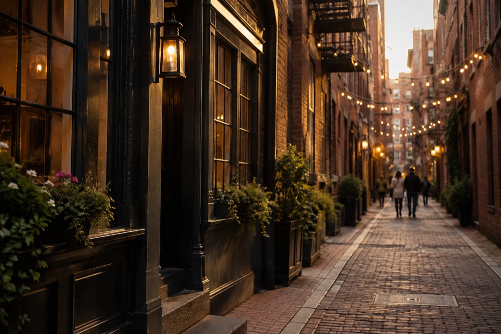
Beacon Hill works in nearly the opposite way. It is quiet, residential and best at times that suit the actual light and access rules; before9am is not always dawn or free of other visitors. The neighborhood's Beacon Hill area guide maps the streets beyond Acorn that most visitors never turn onto, and the Freedom Trail tours comparison is useful here because the trail's downtown section passes within two blocks of the hill, letting a photographer cover both in one morning.
| Neighborhood | Signature Frame | Worst Time | Notes |
|---|---|---|---|
| Beacon Hill | Acorn Street cobblestones, gas lamps | Midday tour groups | Shoot before 9am |
| North End | Hanover Street at dusk, Old North Church spire | None, it stays photogenic | Crowds are part of the frame |
| Charlestown | USS Constitution, Bunker Hill Monument | Flat overcast, ship reads gray | Morning east light is best |
| Back Bay | Copley Square, Trinity Church reflections | Harsh noon | Reflecting pool doubles the church |
| Seaport | Modern glass, harbor, contemporary bridges | Gray rain days | Strongest at blue hour |
| Waterfront | Long Wharf, Custom House Tower | Low tide mud at close range | Check tide predictions first |
When Is The Best Season For Photography In Boston?
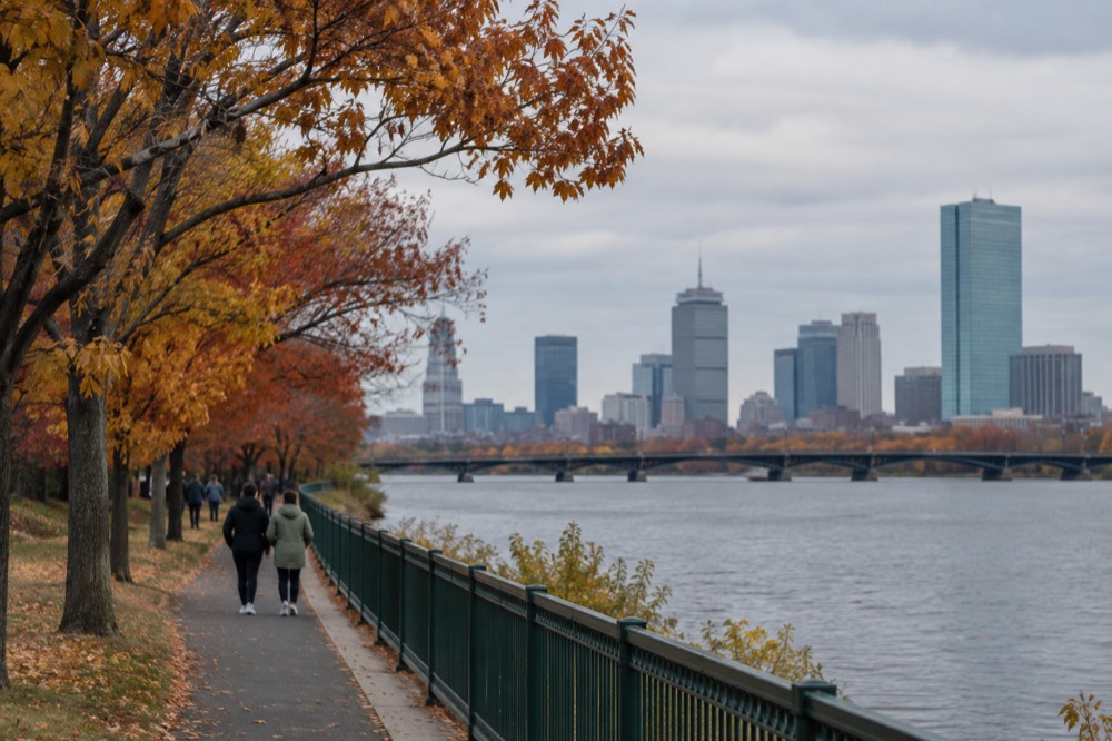
There is no rainy season to plan around in Boston, a fact the NOAA 1991-2020 climate normals make unambiguous: every month of the year records between 3.21 and 4.30 inches of precipitation, barely an inch of spread between the driest and wettest months. What actually changes the pictures is snow and foliage: 49.2 inches of snow falls in an average year, 28.7 inches of it in January and February alone, and October delivers the foliage color along the Charles and in the surrounding hills.
Monthly precipitation averages do not predict the conditions of your trip. Snow cover, foliage, visibility and crowds vary by year and day. Choose the subjects you want, then use the forecast and actual sunrise/sunset times; January does not guarantee snow on Acorn Street or empty sidewalks.
The National Weather Service Boston office provides forecasts. The weather-by-month guide and best-time-to-visit guide explain climate averages, which are measured at Logan and are not a guarantee of softer waterfront light.
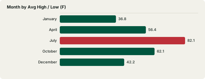
| Month | Avg High / Low (F) | Precip (in) | Snow (in) | Photographic Character |
|---|---|---|---|---|
| January | 36.8 / 23.1 | 3.39 | 14.3 | Snow on brick, clean cold air |
| April | 56.4 / 40.8 | 3.63 | 1.6 | Cherry blossoms, Public Garden waking up |
| July | 82.1 / 66.0 | 3.27 | 0.0 | Late sunsets, sailboats on the Charles |
| October | 62.1 / 47.5 | 4.03 | 0.2 | Foliage along the river, crisp light |
| December | 42.2 / 29.2 | 4.30 | 9.0 | Holiday lights, wettest month, early dark |
What Should Photographers Know About Tides, Tickets And Getting Around?
Check tide predictions for harbor scenes, the exact transit journey and each site’s access or equipment rules. The outdoor Freedom Trail is free to follow, while historic interiors have separate admission and photography policies. MBTA fares include a $2.40 subway single, $11 day pass and $22.50 seven-day pass; eligible transfers last two hours.
The transit detail worth knowing precisely: the MBTA's fare table shows a 1-Day or 7-Day pass on a CharlieTicket starts at purchase, while the same pass on a CharlieCard starts at first use. A photographer arriving at Logan should also know that the Silver Line SL1 is free leaving the airport, from the terminal curb, per Massport's own page, so the trip from the terminal to a downtown hotel can cost nothing. The Boston subway map explained and the CharlieCard and fares guide cover the system in full, and the Logan Airport guide handles the arrival itself.
For indoor photography, check the venue’s policy on flash, tripods, professional work and particular exhibits before buying admission. An attraction pass does not waive those rules. CityPASS offers four choices from its participating list, not a fixed four-site bundle; compare only visits you actually want in the pass guide.
| Shooting Day Plan | Spots Covered | Transit Cost (MBTA fares) | Notes |
|---|---|---|---|
| Dawn to noon | Beacon Hill, Freedom Trail downtown, Charlestown | $2.40 subway each way | Acorn Street before 9am, ferry to Navy Yard side |
| Afternoon | North End, waterfront, Long Wharf | Eligible fares inside two hours; more if the window expires | Check tides for the wharf edge |
| Sunset to night | Esplanade, Zakim Bridge from Cambridge | $2.40 each way | Blue hour runs late in July |
| Full day | All of the above | $11 1-Day pass | Pass on a CharlieTicket starts at purchase |
| Multi-day | Add harbor cruise, islands, museums | $22.50 transit pass; private tickets extra | Harbor Islands ferry season ends October 12, 2026 |
For wildlife, a Boston whale watch is a separate three-to-four-hour offshore outing that may run longer, with no guaranteed sightings or photographic conditions. Gloucester trips require separate travel north; a lower headline ticket does not establish a cheaper complete day. The whale-watching guide compares departure locations.
Curious about photographing wildlife offshore? Explore a Boston whale watch and allow three to four hours plus possible delays. Follow the exact waterfront dock on your ticket and arrive45 minutes early. Sightings and usable shots are not guaranteed; this is not a photography charter. Check Boston whale-watch departures
Common Questions About Boston Photography Spots
where are the best boston photo spots?
The Charlestown Navy Yard for the USS Constitution against the skyline, Acorn Street in Beacon Hill for cobblestones and gas lamps, Hanover Street in the North End at dusk, the Harborwalk from Long Wharf toward the Seaport for skyline-over-water frames, and the Charles River Esplanade at sunset. All five are free to reach.
where can I photograph the Boston skyline?
Compare harborfront views with the Cambridge bank of the Charles for Back Bay. Boats provide moving angles, while View Boston provides elevated views when visibility permits. Check the exact viewpoint, light direction and equipment rules.
what is the most photographed street in Boston?
Acorn Street is a well-known photographed residential lane in Beacon Hill. Respect private property, posted access and residents; do not block doors or assume an ordinary tour ticket grants professional-shoot permission. Use the date’s actual light rather than a fixed9am rule.
when is golden hour in Boston?
It depends on the exact date and conditions. Use local sunrise and sunset times to plan rather than assuming a fixed July hour. Cloud, rain and haze can all change the light.
do Boston tides affect photography?
Yes, in harbor and tidal shoreline scenes. Check the NOAA prediction and its datum for your date; a single low-water figure is not a universal minimum. The dammed Charles River basin is different from the tidal harbor.
is Boston good for night photography?
Yes. The Zakim Bridge from the Cambridge side, the Custom House Tower, the Seaport's lit bridges and the North End's glowing signs all hold up after dark. The MBTA's two-hour unlimited transfer window, in effect from September 1, 2026, makes hopping between night locations cheap, but check weekend service diversions before planning a route home.
Choose The Scene, Then Check Your Date And Conditions
These options do not match your choice. Adjust the selection or reset to explore the starting recommendation.
Compare Your Photography Outing Totals
Reader-entered estimates in USD, not live quotes. Use the same dates and travelers for both options. Include all relevant tickets, rooms, taxes, mandatory fees and transport for the entire trip once in each total. Do not add a transfer twice if your rate already includes it.
Back Bay, Public Garden And Beacon Hill Photo Walk
A two-hour small-group history and architecture walk with smartphone photo tips, not a technical camera class or private photoshoot. Meet by the bronze statue holding a ball outside Boston Public Library on Dartmouth Street, not Boylston, 5–10 minutes early. Reconfirm with the operator at least 48 hours before departure using the voucher contact. Route includes Copley Square, Public Garden and Beacon Hill/Acorn Street; Trinity Church admission is excluded. Confirm access and any interior availability.
A starting option to explore. Choose dates, travelers and the exact booking option with the provider; availability and eligibility are confirmed there.
Check architecture photo-walk dates and meeting point