Boston Beaches: Where To Swim, What To Know, And How To Get There
Boston is a city built on water. The original Shawmut Peninsula was nearly an island when English settlers arrived, and centuries of landfill only pushed the shoreline outward into the harbor it still faces. That geography explains why a visitor can stand in a downtown financial district in the morning and be on a sandy beach by lunchtime without ever leaving the city limits. This guide from Boston Travel Guide covers the beaches themselves, the harbor islands, the water conditions, and the transit connections that make a Boston beach day one of the cheapest days out in the city.
Short answer
Yes, Boston has genuinely swimmable beaches, and they come in three distinct groups: the mainland strands inside city neighborhoods, chiefly South Boston's Carson Beach and M Street Beach plus Constitution Beach in East Boston; the island beaches on the Boston Harbor Islands, especially Spectacle Island; and the ocean beaches just beyond the city, reachable by MBTA. Castle Island in South Boston rounds out the list, a shoreline park where the beach meets nineteenth-century Fort Independence.
Boston Beaches: Where To Swim, What To Know, And How To Get There
Boston is a city built on water. The original Shawmut Peninsula was nearly an island when English settlers arrived, and centuries of landfill only pushed the shoreline outward into the harbor it still faces. That geography explains why a visitor can stand in a downtown financial district in the morning and be on a sandy beach by lunchtime without ever leaving the city limits. This guide from Boston Travel Guide covers the beaches themselves, the harbor islands, the water conditions, and the transit connections that make a Boston beach day one of the cheapest days out in the city.
For an island beach day, explore the Spectacle ferry option and check the route’s operating date and last return. Mainland beaches remain a free alternative reached by transit. Check current beach postings before swimming; a ferry ticket does not establish safe water conditions. Check island ferry dates and destination
Does Boston Have Swimmable Beaches?
Yes, Boston has genuinely swimmable beaches, and they come in three distinct groups: the mainland strands inside city neighborhoods, chiefly South Boston's Carson Beach and M Street Beach plus Constitution Beach in East Boston; the island beaches on the Boston Harbor Islands, especially Spectacle Island; and the ocean beaches just beyond the city, reachable by MBTA. Castle Island in South Boston rounds out the list, a shoreline park where the beach meets nineteenth-century Fort Independence.
The question comes up more often than you would expect, and the short answer on our answers page about swimmable Boston beaches is a plain yes. What surprises most first-time visitors is not the existence of the beaches but their placement. Boston's beaches are not exiled to a distant suburb. They sit inside working neighborhoods, a short walk or bus ride from residential streets, and several of them look straight back at the downtown skyline across the water.
The three groups behave differently, and that shapes how you should plan. The mainland beaches are free, urban and easy to reach, with paved walkways and location-specific summer lifeguard coverage. The island beaches require a ferry ticket but offer different views and a less urban setting, because you swim with the skyline in front of you rather than behind you. The ocean beaches beyond the city, along the coast north and south, trade the harbor's sheltered water for real surf.
What Are The Best Boston Beaches For A Day Out?
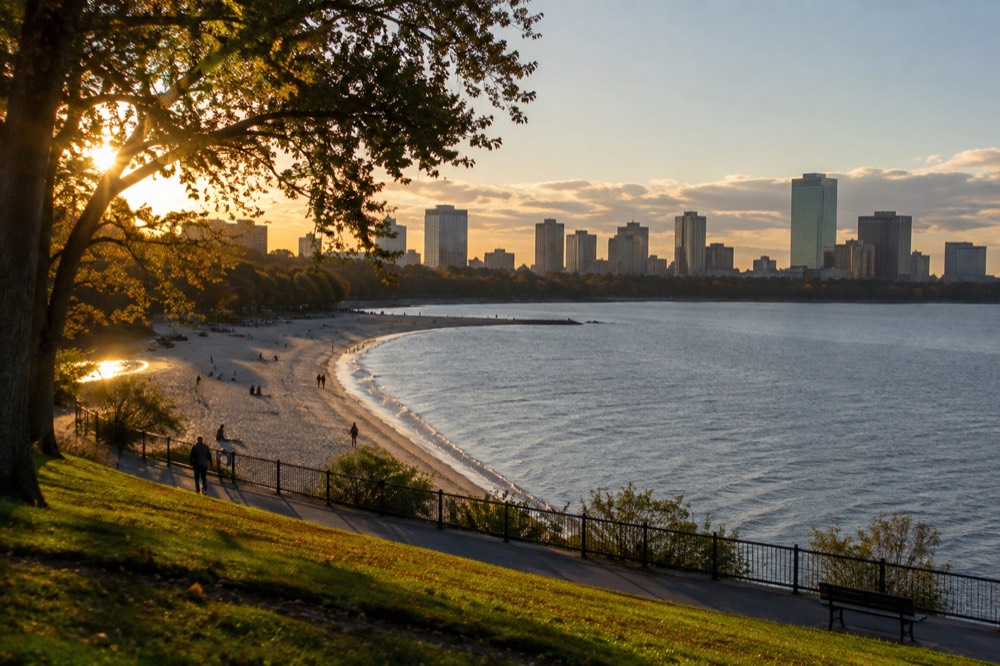
The best mainland picks are Carson Beach and M Street Beach in South Boston, which sit side by side along a continuous waterfront path, and Constitution Beach in East Boston, a compact strand near Logan Airport with a playground and bathhouse. For sand and skyline together, nothing beats Spectacle Island, a ferry ride from Long Wharf, where the beach looks back at downtown across open harbor. Castle Island adds history to the mix.
Carson Beach is the workhorse. It anchors the South Boston shoreline, connects to the Harborwalk and to Castle Island by a paved path, and draws a steady local crowd on summer weekends. M Street Beach, a short walk north, is the smaller and quieter of the pair. Both face the harbor's inner waters rather than the open ocean, though wind, tide, depth and water-quality postings still matter, and both sit on bus routes that run from South Station in minutes.
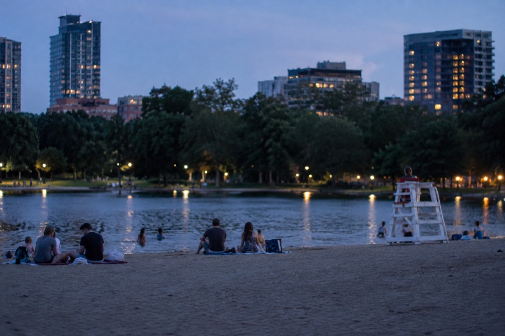
Constitution Beach occupies a different world entirely, on a sliver of land between the airport and an inlet of Boston Harbor. It is a neighborhood beach in the truest sense: a modest strip of sand with a bathhouse, sports courts and a playground, used by East Boston families who walk there. The Blue Line's Orient Heights area and a short bus ride connect it to the rest of the city, and the Logan Airport guide is worth reading if your beach day starts the same day your flight lands.
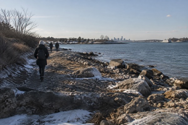
Castle Island deserves its own mention even though its shoreline is more rock and grass than sand. It is a peninsula park at the mouth of the harbor, home to Fort Independence, walking paths and a pier that draws fishermen year-round. Pleasure Bay, the sheltered cove beside it, is one of the calmest swimming spots in the city, and the whole complex connects by path to Carson Beach, so the two make a natural combined walk.
How Do You Get To Boston Beaches Without A Car?
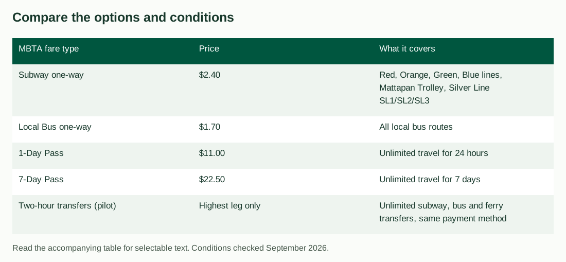
You do not need a car for any of Boston's mainland beaches: the MBTA serves them directly, with a subway fare of $2.40 and a local bus fare of $1.70, and a 1-Day unlimited pass at $11.00 or a 7-Day pass at $22.50. The Silver Line SL1 from Logan Airport is free leaving the terminal curb, with a free Red Line transfer at South Station; a subsequent local bus can require a fare. The Harbor Islands beaches are reached by ferry from downtown.
The MBTA fare table shows the whole picture, and since September 1, 2026 the rules have been better for beach-hoppers than ever: a new pilot allows unlimited transfers between subway, bus and ferry within a two-hour window, paying only the highest-priced leg, as long as you use the same payment method throughout. That means a trip that hops from the subway to a bus and back costs you one fare, not three.
| MBTA fare type | Price | What it covers |
|---|---|---|
| Subway one-way | $2.40 | Red, Orange, Green, Blue lines, Mattapan Trolley, Silver Line SL1/SL2/SL3 |
| Local Bus one-way | $1.70 | All local bus routes |
| 1-Day Pass | $11.00 | Unlimited travel for 24 hours |
| 7-Day Pass | $22.50 | Unlimited travel for 7 days |
| Two-hour transfers (pilot) | Highest leg only | Unlimited subway, bus and ferry transfers, same payment method |
One detail in the fare rules catches out visitors who buy in advance: a 1-Day or 7-Day pass on a CharlieTicket starts counting at purchase, while the same pass on a CharlieCard starts at first use. If you buy the evening you arrive, that difference can be most of a day. The CharlieCard and fares guide and the MBTA subway map explained page cover the mechanics, and the getting around Boston overview puts every mode in one place.
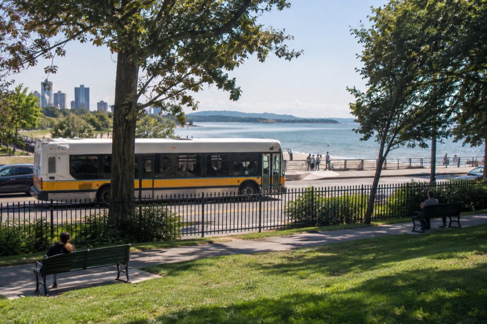
For the beaches themselves, the practical routes are simple. Carson Beach and Castle Island are served by bus routes from South Station and sit within a short ride of the Red Line. Constitution Beach is reached via the Blue Line with a connecting bus or a walk. The ferry to the Harbor Islands leaves from Long Wharf downtown, steps from the Aquarium subway stop. Massport's own airport page notes that the free Silver Line SL1 runs from every terminal curb to South Station, where the rest of the network begins.
What About The Beaches On The Boston Harbor Islands?
Spectacle Island has a designated swimming beach, trails and a visitor center. The designated 2026 swimming season ends September 7 and the beach is unguarded. Check water-quality postings and the exact ferry date. Georges Island is a different excursion for Fort Warren; Peddocks uses a separate Hingham route. A Long Wharf ticket is not a three-island pass.
Check the current provider price for the selected island, age bands and party. Previously published ferry prices and multi-ride offers should not be treated as a current quote. Mainland beaches remain a free alternative.
| Island booking detail | What to check |
|---|---|
| Destination | Spectacle for the designated beach; Georges for Fort Warren |
| Party | Current adult, child and infant ticket rules |
| Route | Long Wharf service is separate from Peddocks/Hingham |
| Return | Last operating return for the selected island and date |
The 2026 Spectacle fall schedule runs Thursday–Sunday September 10–27, Friday–Sunday October 2–11 and Monday October 12. Other islands have different calendars. Check the official ferry schedule for the particular route, rather than applying one season-end date to all islands.
| 2026 Harbor Islands ferry period | Dates |
|---|---|
| Spring schedule | May 15 to June 14 |
| Summer schedule | June 15 to September 7 |
| Fall schedule | September 10 to October 12 |
| Last day of 2026 season | Monday, October 12 |
Allow at least four hours for an island trip: the crossing to Georges Island takes roughly 45 minutes each way, and Spectacle Island about 30 minutes. Choose activities within the actual island opening and return timetable; a fall ferry does not extend the designated swimming season. The selected island round-trip ticket covers the crossing to that island and its return, and the islands themselves charge no admission.
Allow a generous buffer after your island return before any separate city activity. A ferry delay can disrupt a same-day cruise booking, and Duck Tours use the Charles River rather than transporting visitors to beaches.
Curious about skyline views from an island? Explore the Spectacle ferry and select Spectacle rather than Georges. The ticket covers one island round trip. Its designated 2026 swimming season ends September 7 and the beach is unguarded; fall departures suit a shore walk. Check the last return before paying. Check island ferry dates and destination
Is Boston Harbor Water Clean Enough To Swim In?
Boston Harbor has designated swimming beaches, but current water-quality postings determine whether swimming is allowed, and the city's beach season runs with lifeguards and routine water testing at the public strands. The harbor still has one physical quirk every swimmer should know, a mean tidal range of about 9.49 feet, among the largest of any major US city, which visibly reshapes every beach twice a day.
Harbor cleanup has improved water quality, but it does not make every beach safe every day. Check the Massachusetts beach water-quality dashboard and on-site notices before swimming; do not enter the water at a posted beach. The Boston whale watching guide describes the separate offshore sightseeing experience.
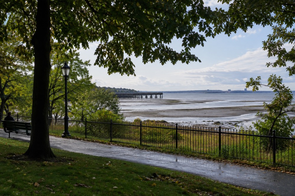
The tides are the detail most visitors never anticipate. NOAA's tide station for Boston, number 8443970, records a mean range of about 9.49 feet, with highs running from roughly 8 to nearly 11 feet above the low-water datum and lows dipping slightly below zero. In practice: the beach you see at noon can look like a different beach at 6pm. A wide stretch of wet sand at low tide becomes a narrow strip at high tide, and the Harborwalk and island landings all shift with it. The NOAA station page publishes the daily predictions.
What Is The Weather Like At Boston Beaches, And When Should You Go?
July is Boston's warmest month at an average high of 82.1°F, with August close behind at 80.4°F, and those two months plus late June are the core beach season. September stays pleasant at a 73.1°F average high, but the lifeguard season and ferry summer schedule end in early September. Boston has no wet season to avoid: every month has precipitation; monthly totals do not show the probability of rain on a given beach day.
The numbers come from NOAA's official climate normals for the Boston station, measured at Logan Airport on the harbor peninsula, which makes them a good match for waterfront conditions. The full month-by-month breakdown lives on our Boston weather by month page, and the best time to visit Boston guide weighs beach weather against crowds and prices.
| Summer month | Avg high | Avg low | Rainfall |
|---|---|---|---|
| June | 76.2°F | 59.7°F | 3.89 in |
| July | 82.1°F | 66.0°F | 3.27 in |
| August | 80.4°F | 65.1°F | 3.23 in |
| September | 73.1°F | 58.2°F | 3.56 in |
Two seasonal limits matter more than the temperature chart. Lifeguard coverage depends on the beach: Carson and Pleasure Bay’s 2026 staffed season ends September 7, while M Street and Spectacle are unguarded. Spectacle’s designated swimming season also ends September 7 even though ferries continue on selected fall dates. Check current postings and use autumn island trips for walking and views instead of assuming swimming is still permitted.
One weather fact worth knowing before you plan around it: Boston's snow, all 49.2 inches of it in a normal year, falls overwhelmingly in January and February, which together account for 58% of the annual total. Winter beach visits are for walkers and photographers, not swimmers, but the shoreline paths around Castle Island and the Harborwalk stay busy all year.
What Can You Do At Boston Beaches Besides Swim?
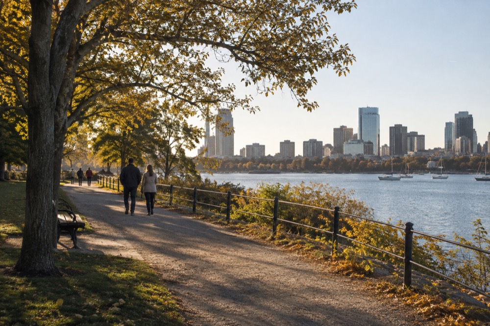
A Boston beach day can be far more than swimming: the shoreline path from Carson Beach to Castle Island is one of the best free walks in the city, the Harbor Islands add fort ruins and hiking trails to their sandy beaches, and the harbor itself is the busiest tour corridor in Boston, with several different sightseeing services and departure locations. Fishing, kayaking and picnicking fill the gaps.
Prefer to end your beach day on the water? Book a sunset cruise ticket here.
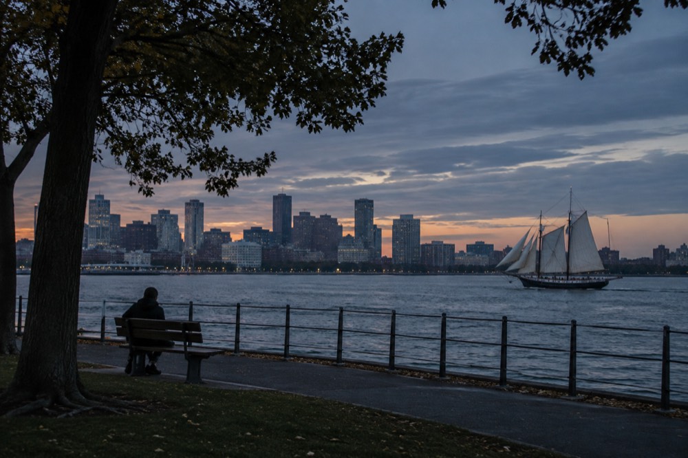
The waterfront activity list includes a one-hour narrated harbor cruise, separate tall-ship sailings and the roughly 80-minute Duck Tour. The Duck Tour combines city streets with a Charles River segment; it does not take visitors to a beach. Compare the actual departure location, operating date and group total when choosing a sightseeing outing.
Out on the islands, Georges Island's Fort Warren, a Civil War-era fort with granite corridors, is the star, and Spectacle Island's walking trails climb to harbor views from the highest point on the island chain. Closer to home, Castle Island's pier draws anglers in every month of the year, and the South Boston beaches sit at one end of a continuous waterfront path system that ties into the things to do in Boston master list. If your beach day falls on a weekend, the things to do in Boston this weekend guide pairs well with it.
What Should A Beach Day In Boston Cost?
A Boston beach day can cost almost nothing: the mainland beaches are free, an all-day transit pass is $11.00, and the Silver Line from the airport is free in the outbound direction. The ferry and an optional harbor cruise add their current date-specific ticket costs, and food is the main variable, with a sit-down seafood meal downtown costing far more than a picnic carried onto the sand.
The honest budget breakdown is top-heavy on food and tours, light on admission, because most of the beaches themselves cost nothing. What follows is the realistic spread for one person, one day, using current fares and your actual date-specific booking totals.
| Beach day item | Budget basis |
|---|---|
| Subway each way | $2.40 per paid ride; two rides total $4.80 |
| Mainland beach admission | Free |
| Island ferry | Current date and party quote |
| Optional harbor cruise | Separate ticket; not included in island fare |
| Food | Your picnic or restaurant estimate |
For a fuller cost picture across a whole trip, the where to stay in Boston guide covers the accommodation side, and the best restaurants in Boston and best lobster rolls in Boston pages handle the eating side. A lobster roll within sight of the water is a Boston ritual, and the waterfront around Long Wharf and the Seaport is where most visitors end up having one.

Where Should You Stay To Be Near Boston Beaches?
South Boston is the neighborhood to stay in for the mainland beaches: Carson Beach, M Street Beach, Pleasure Bay and Castle Island all sit on its shoreline, a short bus ride from South Station and the Red Line. East Boston puts you beside Constitution Beach and closest to the airport, while downtown and the Waterfront put the Harbor Islands ferry at Long Wharf within walking distance. None of Boston's beach areas require a car.
The choice comes down to which beach group you want as your default. A South Boston base gives you the morning beach walk and the evening skyline view. A downtown or Long Wharf base makes the ferry commute trivial and puts the harbor cruises at your door, which matters if the duck boat or a whale watch is on your list. East Boston is another option; compare actual stay totals, with the beach and the airport on one side and a short Blue Line ride to downtown on the other.
Families should read the Boston with kids guide before booking, because the beach-and-playground combination at Constitution Beach and the ferry adventure to Spectacle Island are two of the better child-friendly days the city offers. And if you are weighing a pass that bundles several paid attractions around your beach days, the CityPASS comparison guide works through the arithmetic.

Want to stay close to the island ferry departure? Explore Boston Marriott Long Wharf beside the Aquarium. Compare the exact room and full stay total for your party. This is a downtown waterfront hotel, not a beachfront resort, and ferry tickets are separate. Check rooms at Boston Marriott Long Wharf
Common Questions About Boston Beaches
does boston have swimmable beaches?
Yes. Carson Beach, M Street Beach and Pleasure Bay in South Boston, Constitution Beach in East Boston, and the swimming beach on Spectacle Island are all swimmable, with lifeguard coverage varying by beach; Spectacle and M Street are unguarded in 2026. Check the current Spectacle ferry fare and any posted swimming closure.
Can you swim in Boston Harbor?
Yes, at the monitored public beaches. Decades of cleanup work, anchored by the Deer Island treatment plant, transformed the harbor from a place closed to swimming into one where the city's beaches operate with lifeguards and routine water testing in summer. The calmest swimming is in the sheltered coves like Pleasure Bay rather than the open harbor channels.
What is the closest beach to downtown Boston?
The South Boston beaches are the closest mainland strands to downtown, a short bus ride from South Station. The closest beach experience by water is Spectacle Island, a roughly 30-minute ferry crossing from Long Wharf, which sits downtown on the waterfront.
When do Boston beaches close for the season?
The lifeguarded summer season at the public beaches winds down in early September, and the Harbor Islands ferry's summer schedule ended September 7, 2026, with a reduced fall schedule running to the season's last day on Monday, October 12, 2026. The beaches themselves remain open to walkers year-round; check current swimming restrictions and lifeguard schedules.
Is a Boston beach day expensive?
No, it can be one of the cheapest days in the city. The mainland beaches are free, a 1-Day MBTA pass is $11.00, and the Silver Line SL1 from Logan Airport is free leaving the terminal curb. The Harbor Islands ferry adds its current ticket cost, and food is the main variable cost.
Do the tides matter at Boston beaches?
Yes, more than at most American beaches. NOAA's Boston tide station records a mean tidal range of about 9.49 feet, so the waterline moves dramatically between high and low tide. A wide beach at low tide can become a narrow strip six hours later, so check the daily tide predictions before you set up for the day.
Choose The Island And Check Your Return Boat
These options do not match your choice. Adjust the selection or reset to explore the starting recommendation.
Compare Your Ferry And Beach Day Totals
Reader-entered estimates in USD, not live quotes. Use the same dates and travelers for both options. Include all relevant tickets, rooms, taxes, mandatory fees and transport for the entire trip once in each total. Do not add a transfer twice if your rate already includes it.
Boston Harbor Islands Ferry
Choose an available Spectacle or Georges Island departure. Spectacle Beach is unguarded in 2026, and its designated swimming season ends September 7. The ticket has a timed outward departure and open return on operating services to Boston; no inter-island service. Check the seasonal timetable and final return.
A starting option to explore. Choose dates, travelers and the exact booking option with the provider; availability and eligibility are confirmed there.
Check island ferry dates and destination