South Boston
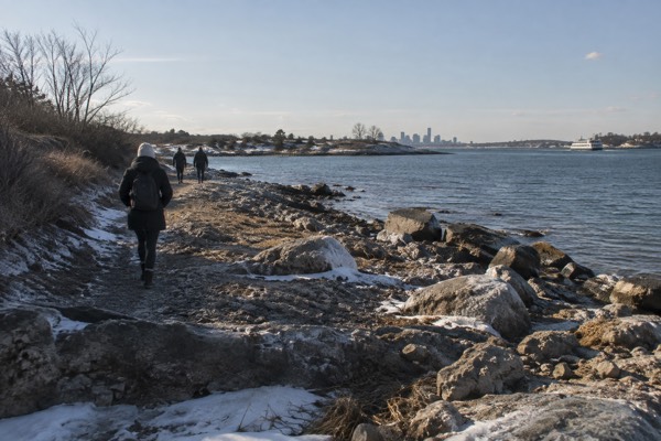
South Boston is the peninsula that sits south of the Fort Point Channel and east of Roxbury's old shoreline, and it is one of the few Boston neighborhoods where a single walk can take you from a Revolutionary fortification to a harbor beach to a glass office tower in under an hour. The National Park Service counts Dorchester Heights, on the neighborhood's western ridge, among the free sites of Boston National Historical Park, and the fortifications there ended the British siege of Boston in 1776. The eastern edge is water nearly the whole way around: Castle Island and Pleasure Bay to the southeast, M Street Beach and Carson Beach along the shore, and the deep-water harbor channel that ocean-going ships still use. This Boston Travel Guide page lays out what the neighborhood actually contains, how to reach it, and how to plan a day there without relying on the vague "Southie" shorthand that most visitors arrive with.
Short answer
South Boston is the peninsula directly south of downtown, bounded by Fort Point Channel and the South End to the west, Dorchester Bay and the harbor to the east and south, and the Fort Point and Seaport waterfront to the north. Its northern edge, the Seaport District, is technically part of South Boston and has been almost entirely rebuilt since 2000. Cambridge and Somerville are separate cities and Brookline is a separate town and none of them touch it.
South Boston
South Boston is the peninsula that sits south of the Fort Point Channel and east of Roxbury's old shoreline, and it is one of the few Boston neighborhoods where a single walk can take you from a Revolutionary fortification to a harbor beach to a glass office tower in under an hour. The National Park Service counts Dorchester Heights, on the neighborhood's western ridge, among the free sites of Boston National Historical Park, and the fortifications there ended the British siege of Boston in 1776. The eastern edge is water nearly the whole way around: Castle Island and Pleasure Bay to the southeast, M Street Beach and Carson Beach along the shore, and the deep-water harbor channel that ocean-going ships still use. This Boston Travel Guide page lays out what the neighborhood actually contains, how to reach it, and how to plan a day there without relying on the vague "Southie" shorthand that most visitors arrive with.
Adding a paid outing to South Boston’s free fort and beach walks? Explore the seafood tour on the northern Seaport waterfront. It does not visit Castle Island or the residential pub district, and dietary restrictions matter. Check Seaport seafood walk dates
Where Is South Boston, And What Counts As It?
South Boston is the peninsula directly south of downtown, bounded by Fort Point Channel and the South End to the west, Dorchester Bay and the harbor to the east and south, and the Fort Point and Seaport waterfront to the north. Its northern edge, the Seaport District, is technically part of South Boston and has been almost entirely rebuilt since 2000. Cambridge and Somerville are separate cities and Brookline is a separate town and none of them touch it. The neighborhood's shape matters for planning more than most: it is roughly two miles from the Seaport's northern tip to Castle Island in the southeast corner, and the residential core sits on a ridge between them. Locals divide it informally into South Boston proper, the beaches along City Point, and the Seaport, and a visitor who lumps all three together will plan badly, because the Seaport is walkable from downtown and Castle Island is not. The Seaport has its own guide if the glass-and-steel half is your main interest.
The older residential grid runs from Broadway east toward the water, a fabric of triple-deckers, parish churches and corner stores that predates the Seaport boom by more than a century. Broadway itself is the spine, running from the Fort Point Channel across the peninsula to City Point, with the Red Line at Broadway station and farther south at Andrew Square. The western ridge above the grid is Dorchester Heights, the high ground that makes sense of the whole neighborhood once you stand on it: from the monument there you can see why the Continental Army put cannon there, because the entire harbor channel and the city below fall into view.
What Are The Top Things To See In The South Boston Neighborhood?
Dorchester Heights, Castle Island, the Day Boulevard beaches and the northern Seaport waterfront are the main stops. The Heights commemorates the 1776 fortification that led to the British evacuation. Castle Island’s surviving granite Fort Independence dates to the nineteenth century, although earlier forts occupied the site. The public grounds are free; interior access follows separate schedules.
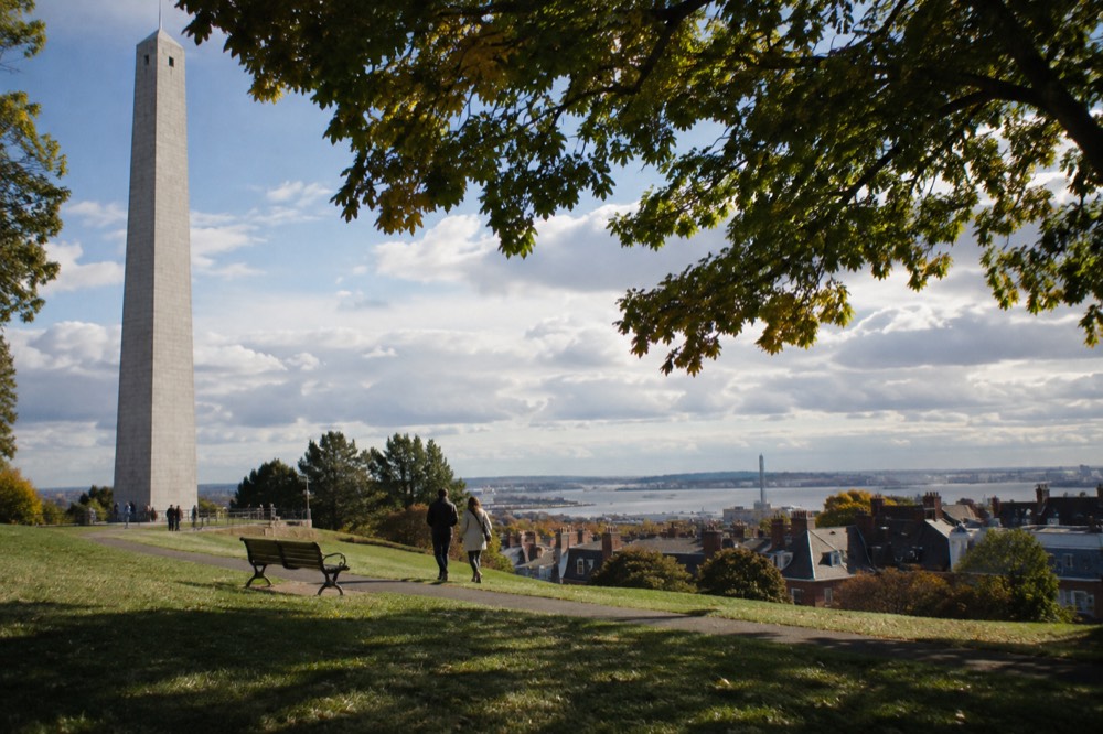
Dorchester Heights is the place to start, because it explains everything else. The National Park Service's published hours-and-fees page for Boston National Historical Park lists it among the free sites, alongside Bunker Hill and the Charlestown Navy Yard, and the monument there commemorates the night of 4 March 1776, when Henry Knox's cannon hauled from Fort Ticonderoga appeared on the hill and made the British position in Boston untenable. The British evacuated on March 17, 1776. The park service's page, at nps.gov/bost, carries the current hours, which vary by season.
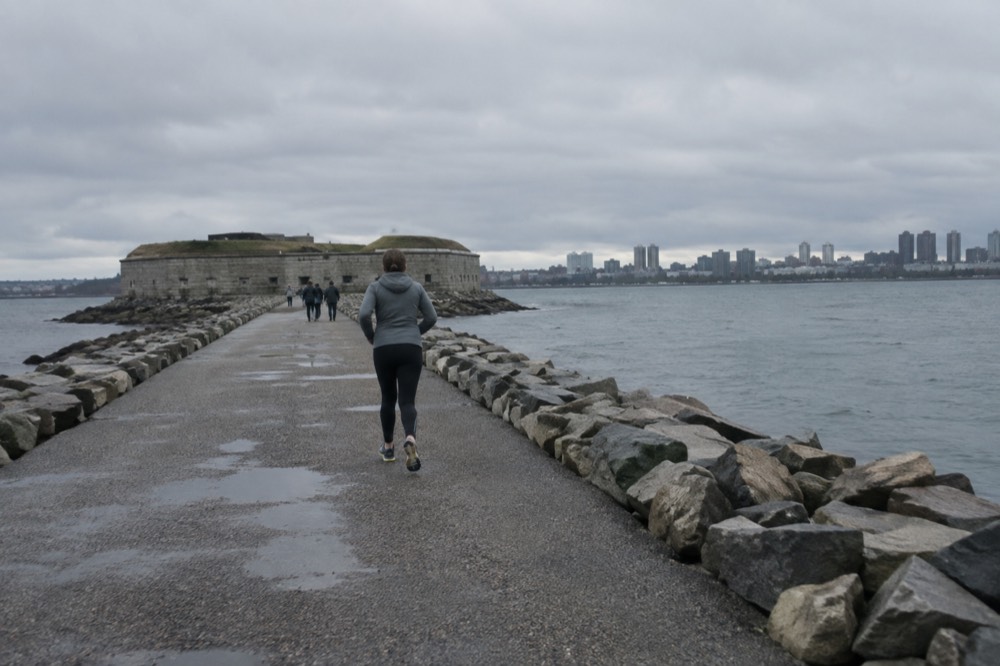
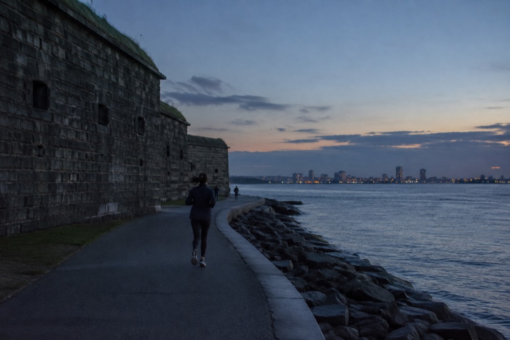
Castle Island sits at the other end, connected to the mainland by a causeway since the 1920s, so it is no longer an island in anything but name. Fort Independence, the granite pentagon on its summit, is the eighth fortification to stand on the spot, and the island's walking loop around Pleasure Bay is one of the most-used free promenades in the city. The fort itself has seasonal open hours run by a local volunteer group, so treat the loop and the views as the guaranteed part and the interior tour as a bonus.
How Do You Get To South Boston Without A Car?
The Red Line serves the neighborhood directly at Broadway and Andrew stations for a $2.40 subway fare, the Silver Line serves the Seaport edge, and the MBTA's fare rules changed on 1 September 2026 to allow unlimited transfers within a two-hour window while paying only the highest-priced leg. A 7-Day pass at $22.50 or a 1-Day pass at $11.00 covers unlimited rides, and the pass starts at purchase on a CharlieTicket but at first use on a CharlieCard. The fare table and the transfer rules are published at mbta.com/fares, and the two-hour window is the single most useful change for a visitor, because a South Boston day typically involves a subway leg, a bus leg and a return, and under the old rules the third leg could cost extra.
The practical routes are simple. From downtown, the Red Line from South Station or Downtown Crossing reaches Broadway in two or three minutes, and Broadway is the natural gate for Dorchester Heights and the residential grid. For Castle Island and the beaches, MBTA bus routes along Day Boulevard and City Point avenues run from Broadway station, and the ride is short but real, roughly the distance a walker would cover in forty minutes. From the airport side, the Silver Line SL1 runs free from the Logan terminal curb to South Station, as Massport's own page at massport.com states, and from South Station the Seaport is a short Silver Line hop or a fifteen-minute walk across the channel.
| Route | Serves | One-way fare | Notes |
|---|---|---|---|
| Red Line (Broadway, Andrew) | Residential core, Dorchester Heights approach | $2.40 | Fastest link from South Station and downtown |
| Silver Line (SL1, SL2, SL3) | Seaport edge, South Boston waterfront | $2.40 | SL1 is free leaving Logan from the terminal curb |
| Local bus routes | City Point, beaches, Castle Island | $1.70 | Connect from Broadway station |
| 1-Day pass | All subway and bus | $11.00 | 24 hours from first use on a CharlieCard |
| 7-Day pass | All subway and bus | $22.50 | Compare with your actual rides; duration alone does not establish value |
One caveat belongs here: the MBTA has been running rolling weekend diversions on several lines through autumn 2026, including work on the Red Line, and free shuttle buses replace trains on affected segments. Check the MBTA's service alerts on the morning you travel, because a weekend closure can turn a two-minute subway hop into a shuttle ride that adds twenty minutes.
Is South Boston Safe For Visitors?
South Boston contains residential streets, beaches, parks and the Seaport’s commercial waterfront. Plan around current local information, venue hours and your return route. A neighborhood’s old reputation or popularity cannot guarantee personal safety. The South Boston background guide explains the distinction between its historical reputation and a present-day visit.
What Are The Beaches Like, And When Should You Go?
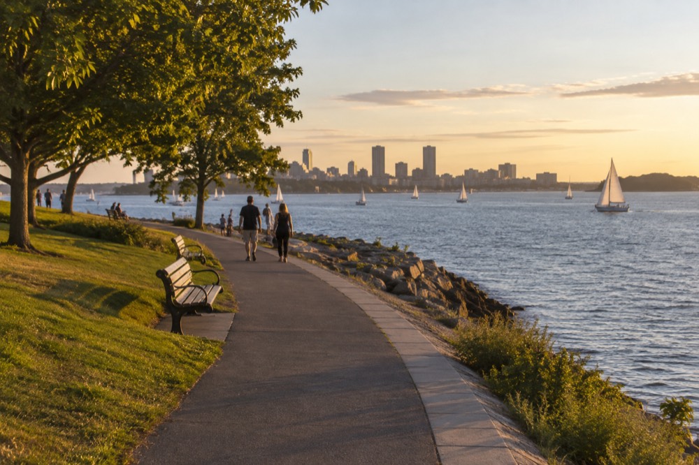
Carson Beach, M Street Beach and Pleasure Bay offer free waterfront access along South Boston. Swimming depends on current posted water-quality and closure notices, weather and conditions; protected harbor water is not automatically safe water. DCR’s 2026 staffed swimming season at Carson and Pleasure Bay ended September 7, and M Street is unguarded.
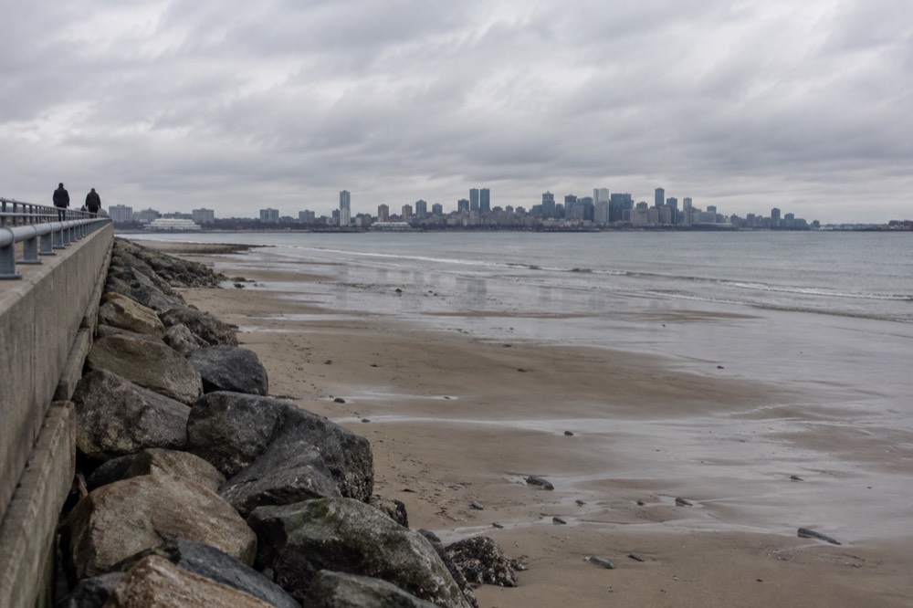
The Day Boulevard promenade links different beach areas and Castle Island. Pleasure Bay is enclosed by the causeway, Carson has a bathhouse, and M Street offers another shoreline access point. Boston’s mean tidal range is about 9.49 feet, but local water levels and conditions vary; beach width generally decreases as the tide rises. Follow posted notices rather than using a scenic appearance as swimming advice.
What Is The Difference Between South Boston And The Seaport?
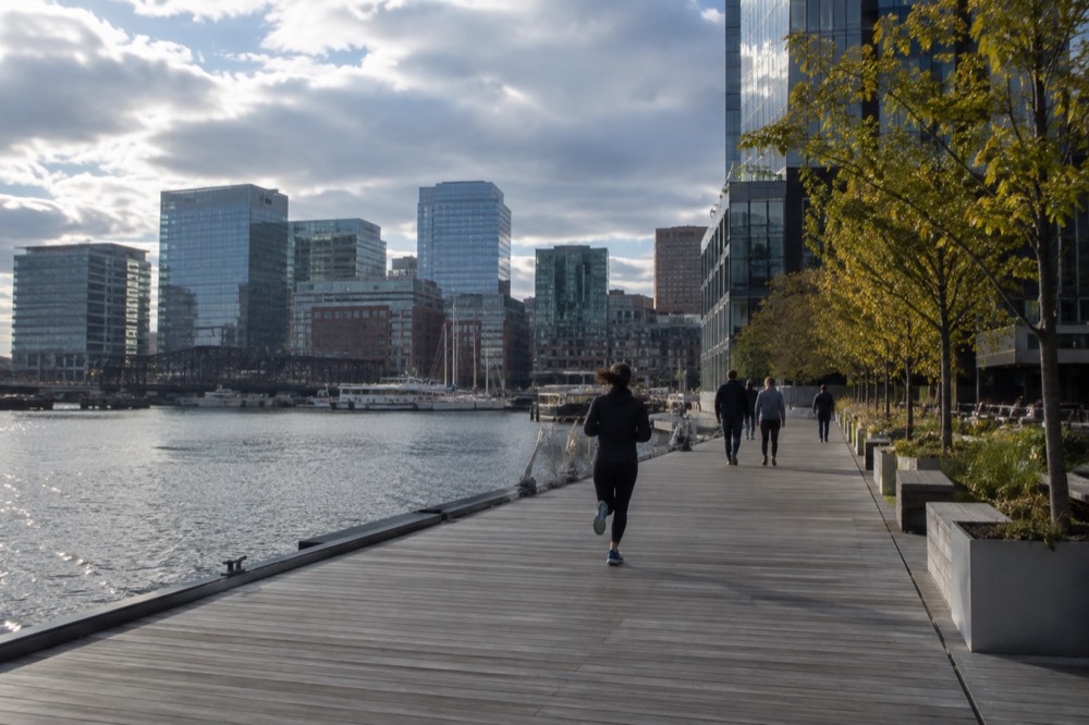
The Seaport District is the northern edge of South Boston, rebuilt since 2000 from vacant piers and parking lots into offices, hotels, museums and a harborwalk, while the rest of the peninsula is an older residential grid of triple-deckers and parish churches. Same peninsula, two different worlds: the Seaport is where the money and the new construction are, and City Point is where the neighborhood's long-term residents are. The line between them is roughly the Fort Point Channel and the convention center, and a visitor can stand with one foot in each within a ten-minute walk. The Seaport's attractions, the ICA's free Thursday nights among them, sit on South Boston's land, but they function as downtown-adjacent sights rather than neighborhood ones, and the Seaport guide covers them in full.
The contrast is the information gain here, because most first pages of search results treat "Seaport" and "South Boston" as synonyms and they are not. The residential grid has its own commercial streets, its own pubs and bakeries, and a pace that has nothing to do with the glass towers. If your hotel is in the Seaport, understand that dinner at a City Point pub is a bus ride away, not a stroll, and if you are staying downtown, the reverse holds. The two halves are worth seeing in one day precisely because the contrast is so sharp.
How Does South Boston Fit Into A Boston Trip?
South Boston works best as a half-day excursion from a downtown or Back Bay base, pairing Dorchester Heights and Castle Island in a loop, or as an add-on to a Seaport museum morning. It is not a substitute for the Freedom Trail, the North End or Fenway Park, and a first-time visitor with two or three days should see those first. With four or more days, or on a repeat visit, the peninsula earns a full half-day of its own. The reason is simple arithmetic: the neighborhood's two signature sights are free but sit at opposite ends of a two-mile peninsula, so the half-day is mostly walking and transit time between very good stops. That trade is worth it for history and harbor views, and not worth cutting a Freedom Trail day short for.
A sensible loop runs like this: Red Line to Broadway, up to Dorchester Heights for the monument and the view, back down through the Broadway grid toward the water, then a bus or a long walk along Day Boulevard to Castle Island and Pleasure Bay, and a return along the beach promenade. Reverse it if you are coming from the Seaport. In summer, add the beach as the final stop and treat the promenade as the walk back.
| If you have | Do this in South Boston | Skip |
|---|---|---|
| Half a day | Dorchester Heights, Broadway grid, Castle Island loop | The beach, unless summer |
| A summer half-day | Castle Island, Pleasure Bay, beach promenade | Dorchester Heights interior |
| A full day | All of the above plus the Seaport museums | Nothing |
| A rainy day | Seaport museums and the ICA's free Thursday evening, 5 to 9pm | The beaches and the fort loop |
When Is The Best Time To Visit South Boston?
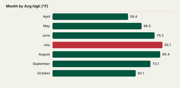
Boston has no wet season and no dry season, with every month between 3.21 and 4.30 inches of precipitation in the NOAA 1991-2020 normals, so rain planning matters more than season choice; July is the warmest month at an 82.1 °F average high, and the harbor beaches are best from June through September. Winter brings the snow: 49.2 inches falls in a normal year, and 58% of it lands in January and February alone. Those figures come from the NOAA station at Logan Airport, which sits on a harbor peninsula much like South Boston itself, so the reading is an unusually good match for conditions on the beaches. The practical translation: summer is the beach season, autumn is the best walking season, and the neighborhood's outdoor sights lose most of their appeal from December through February.
| Month | Avg high (°F) | Avg low (°F) | Precip (in) | Beach? |
|---|---|---|---|---|
| April | 56.4 | 40.8 | 3.63 | No, too cold |
| May | 66.5 | 50.3 | 3.25 | Borderline |
| June | 76.2 | 59.7 | 3.89 | Yes |
| July | 82.1 | 66.0 | 3.27 | Yes, warmest |
| August | 80.4 | 65.1 | 3.23 | Yes |
| September | 73.1 | 58.2 | 3.56 | Early month, yes |
| October | 62.1 | 47.5 | 4.03 | Walking, not swimming |
One seasonal note that most guides miss: the Boston Harbor Islands ferry, which departs from Long Wharf and serves Georges and Spectacle Islands visible from South Boston's beaches, ends its 2026 season on 12 October 2026, with fall service varying by island and date. The ferry's own schedule page carries the dates. If a harbor-islands day is on your list, it is a warm-season plan.
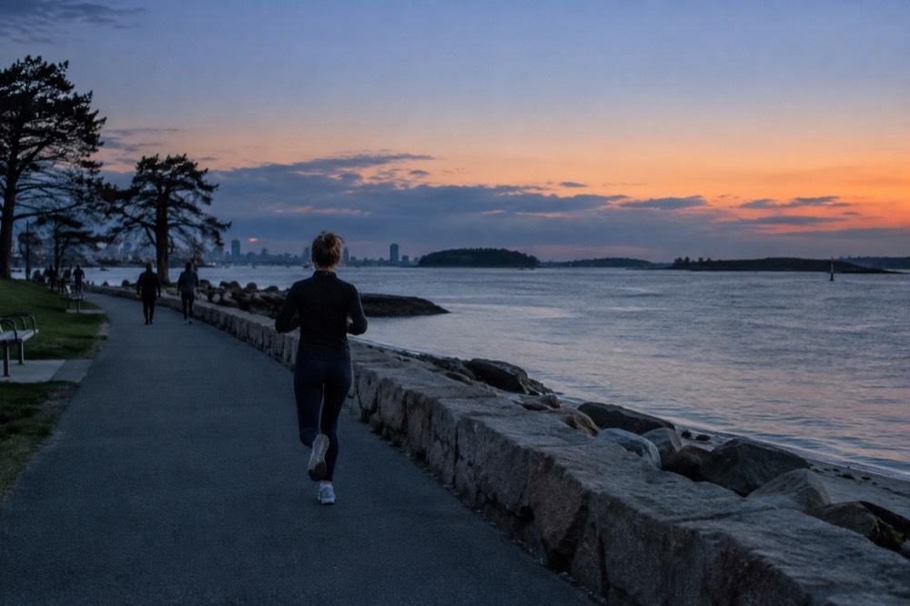
Want to visit one of the islands you can see from shore? Explore the seasonal ferry to Georges or Spectacle Island. It boards at downtown Long Wharf, not Castle Island; check the final return for your chosen date. Check island ferry dates and destination
What Should You Eat In South Boston?
The neighborhood's food identity runs to old-school bakeries, sub shops, seafood and Irish pubs in the residential grid, and a dense strip of newer restaurants in the Seaport at its northern edge. The classic move is a lobster roll or a fried-seafood plate near the beaches, and the North End's Italian quarter remains the city's best eating neighborhood a subway ride away. South Boston's own plates are unpretentious: corner bakeries that have been running for decades, roast beef and pizza shops, and pub kitchens that do a solid chowder. The Seaport, by contrast, is where the chef-driven rooms and the hotel restaurants are, and prices there run at the high end of the city's range. This site's North End guide covers the Italian quarter, and the South End and Back Bay carry the city's other major dining districts.
For a day on the peninsula, the practical pattern is breakfast from a Broadway bakery, a sub or a seafood shack near the beaches at midday, and dinner either in the Seaport or back across the channel downtown. The seafood-shack experience near City Point is closer to a counter and a bench than a restaurant, which is part of the point: it is the same harbor the ferry crosses, viewed from the cheap seats.
Where Should You Stay In South Boston?
Many South Boston visitor hotels are in the Seaport, while other addresses sit closer to Broadway, Andrew or the convention center. Compare the precise location against your plans rather than assuming all South Boston accommodation is waterfront. Beacon Hill and Back Bay offer other styles of base; actual prices and facilities vary by property and date.
For a Seaport base, check the final walk from the Silver Line stop and the route to Castle Island or Broadway. SL1 is free when boarding at Logan; the reverse journey is not universally free. The Red Line at South Station serves some areas directly and requires transfers for others. The neighborhood overview helps compare destinations.
Would a Seaport hotel suit your actual South Boston route? Explore the Boston hotel map and compare precise addresses, room totals and transit to Castle Island. Citywide results do not guarantee a room in the residential neighborhood. Compare Boston stays
What Tour Bookings Pair Well With A South Boston Day?
A Seaport seafood walk or a narrated harbor cruise can add a paid outing to a South Boston visit. They cover different routes: the seafood walk stays on the northern waterfront, and the selected harbor cruise departs from downtown Long Wharf. Duck Tours spend their water segment on the Charles River, away from Castle Island. Allow the journey to each meeting point and keep free park and fort visits separate.
The Harvard University Campus Guided Walking Tour, from $23 per person and rated 4.7 from 3,864 reviews on its listing, runs 1 hour 10 minutes and makes sense as the afternoon half of a day that starts on the peninsula: the Red Line from South Station reaches Harvard Square directly, so a morning at Castle Island and an afternoon in Cambridge connect without a car. Its listing shows a 1 hour 10 minute runtime, which leaves the evening free.
The North End food walk, from $70 per person and rated 4.9 from 1,635 reviews, is the dinner-adjacent choice, and it starts a short Red Line ride from South Boston. The operator's live listing carries current times and availability.
The Boston Duck Boat Sightseeing City Tour with Cruise, from $62 per person and rated 4.6 from 10,003 reviews over 1 hour 20 minutes, is an optional city-and-Charles-River family outing. Its listing shows the amphibian splashdown as the signature moment, on the Charles River rather than the harbor beside Castle Island.
Check Long Wharf cruise departures before setting your South Boston walking schedule. This one-hour narrated harbor trip is a separate outing from downtown, with refreshments extra; allow time to reach the boarding point. Check harbor cruise departure times
Common Questions About South Boston
is south boston a tough neighborhood
Its historical reputation does not establish present-day conditions or guarantee anyone’s safety. Plan around current local information, the places you intend to visit and your return transport. See the site’s South Boston background guide for context.
What is the difference between South Boston and Southie?
None in geography: "Southie" is the long-standing local name for South Boston. The nuance is that "Southie" usually refers to the older residential grid and City Point, while the rebuilt Seaport District at the peninsula's northern edge is the same land but a different world, and locals rarely call the Seaport "Southie."
Is the Seaport part of South Boston?
Yes. The Seaport District sits on South Boston's land at the peninsula's northern edge, across the Fort Point Channel from downtown. It was rebuilt from vacant piers into the city's newest office, hotel and museum district after 2000.
Is Castle Island actually an island?
Not anymore. It was connected to the mainland by a causeway, completed in the 1920s, so it is now a walkable peninsula at South Boston's southeastern tip. Fort Independence, the granite fort on its summit, is the eighth fortification built on the site.
Is Dorchester Heights free to visit?
Yes. The National Park Service lists Dorchester Heights among the free sites of Boston National Historical Park, alongside Bunker Hill and the Charlestown Navy Yard. Hours vary by season and are published on the park's hours-and-fees page.
Can you swim at the South Boston beaches?
Use current DCR water-quality and closure notices before entering the water. Carson and Pleasure Bay’s staffed 2026 swimming season ended September 7; M Street is unguarded. Enclosed harbor water does not guarantee safe conditions.
Choose A Waterfront Addition To Your South Boston Day
These options do not match your choice. Adjust the selection or reset to explore the starting recommendation.
Compare Your South Boston Day Totals
Reader-entered estimates in USD, not live quotes. Use the same dates and travelers for both options. Include all relevant tickets, rooms, taxes, mandatory fees and transport for the entire trip once in each total. Do not add a transfer twice if your rate already includes it.
Seaport Seafood And Fish Pier Walk
A roughly 2.5-hour Seaport seafood walk with around two miles on foot and tastings amounting to a meal. Shellfish is central: not suitable for shellfish allergies, vegetarians or vegans. Other dietary needs require advance notice. Drinks and extra food are separate.
A starting option to explore. Choose dates, travelers and the exact booking option with the provider; availability and eligibility are confirmed there.
Check Seaport seafood walk dates