The South End, Boston: Brownstones, Galleries And Restaurant Rows
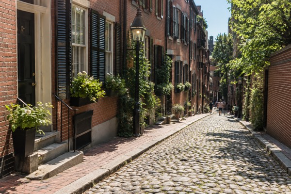
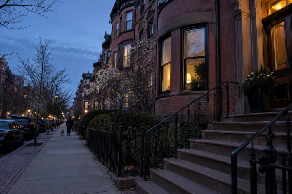
The South End is the neighborhood people picture when they picture old Boston brick: rows of Victorian rowhouses, cast-iron railings, small pocket parks, and church spires, all laid out on nineteenth-century landfill just south of Back Bay. It is a residential district first and a sightseeing district second, which is exactly why it rewards a half-day of unhurried walking between meals. This Boston Travel Guide page covers how to get there, what to do, where to eat, and what it costs, with the MBTA's own fare tables and the venues' own admission pages as the sources for every number.
Short answer
The South End is known for having one of the largest concentrations of Victorian brick rowhouses in the United States, laid out around small residential squares and parks, and for a restaurant scene that runs along Tremont Street, Columbus Avenue, and Washington Street. It is a separate neighborhood from the South Boston across the channel, and it is not part of Back Bay even though the two sit side by side. Its landmarks are residential and culinary rather than revolutionary.
The South End is the neighborhood people picture when they picture old Boston brick: rows of Victorian rowhouses, cast-iron railings, small pocket parks, and church spires, all laid out on nineteenth-century landfill just south of Back Bay. It is a residential district first and a sightseeing district second, which is exactly why it rewards a half-day of unhurried walking between meals. This Boston Travel Guide page covers how to get there, what to do, where to eat, and what it costs, with the MBTA's own fare tables and the venues' own admission pages as the sources for every number.
Want to discover the South End through its own kitchens and brownstone streets? Explore the local food-and-history walk, with meal-sized tastings over roughly three hours. It is for ages 12 and up; arrange dietary needs ahead. Check South End food walk dates and dietary terms
What Is The South End Known For?
The South End is known for having one of the largest concentrations of Victorian brick rowhouses in the United States, laid out around small residential squares and parks, and for a restaurant scene that runs along Tremont Street, Columbus Avenue, and Washington Street. It is a separate neighborhood from the South Boston across the channel, and it is not part of Back Bay even though the two sit side by side. Its landmarks are residential and culinary rather than revolutionary.
The distinction matters, because search results and casual usage blur it constantly. The South End is the inland neighborhood of brownstones between Back Bay and Roxbury; South Boston is the peninsula across Fort Point Channel, a different place with a different history, and the question is South Boston a tough neighborhood belongs to that peninsula, not to the rowhouses on Union Park. The South End's own history is shorter than it looks: the whole district stands on land filled from tidal marsh in the nineteenth century, and its street grid and rowhouse blocks were laid out as a planned upscale suburb of its day.
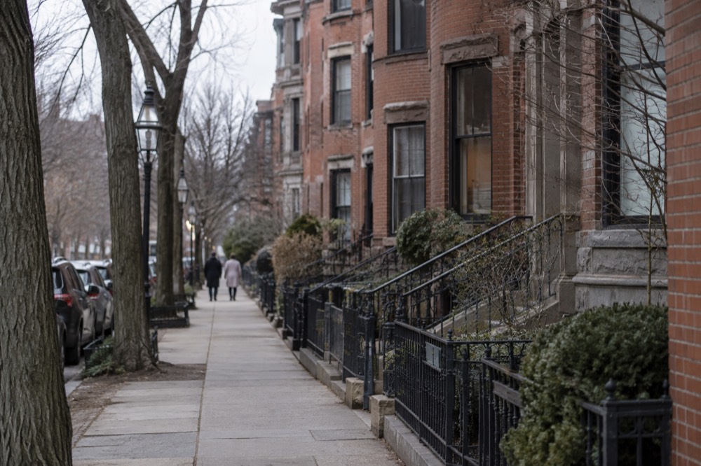
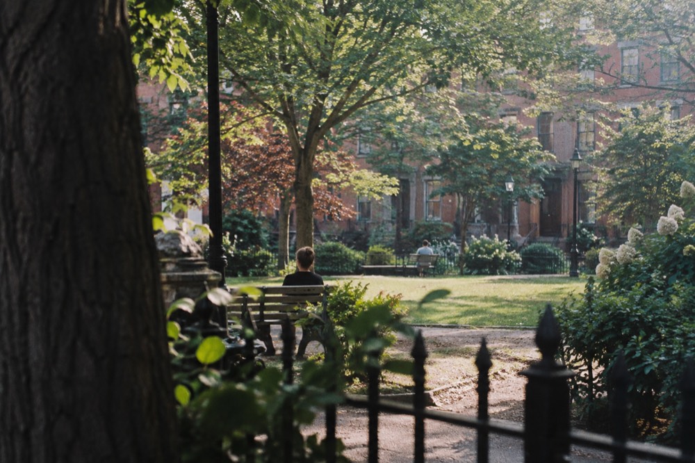
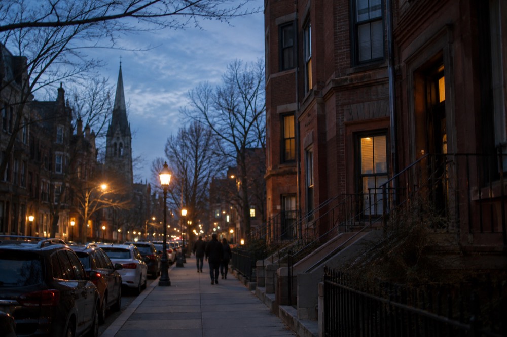
What a visitor actually sees on the ground is consistent block after block: five-story rowhouses with bowfront bays, hairdressers and bakeries at street level, and restaurant clusters that fill up on weekends. The neighborhood's cultural anchors include the Boston Center for the Arts complex, the SoWa Art + Design District around Harrison Avenue, and a set of small parks, Union Park, Chester Park, and Blackstone Square among them, that give the district its rhythm. For a first-time visitor weighing it against other districts, the comparison page on things to do in Boston places it in context.
How Do You Get To The South End On The MBTA?
A one-way subway ride costs $2.40, a 1-Day unlimited pass costs $11.00, and a 7-Day pass costs $22.50, per the MBTA's published fare table. The South End is served by the Orange Line through Back Bay station on its edge and by several bus routes through the neighborhood itself. Since 1 September 2026, riders can transfer between subway and bus as many times as they like within two hours and pay only the highest-priced leg.
The MBTA fare table shows the full structure: subway $2.40, local bus $1.70, and passes at the prices above. The transfer rule that changed on 1 September 2026 is the biggest practical improvement in years, and the MBTA's fares page describes it in full: unlimited transfers within a two-hour window using the same payment method, paying only the cost of the highest-priced leg. Previously riders were limited to two transfers. Contactless Tap to Ride with a card or phone is live on bus, subway, and ferry, which means most visitors never need to buy a physical card at all.
Two operational notes matter for anyone visiting this particular neighborhood. Symphony station on the Green Line E branch has been closed since June 2026 for accessibility work with closure scheduled through spring 2029, which affects anyone who would otherwise ride the E line toward the neighborhood's northern edge. And the MBTA has been running rolling weekend diversions through September and into October 2026, including a full central Green Line suspension on the weekend of 19 to 20 September 2026, so a weekend visitor should check service before relying on any single line. Free shuttle buses replace the closed segments.
Arriving from Logan Airport, the cheapest route is also the simplest one. Massport's own transport page states that the Silver Line SL1 provides free service between South Station and all airport terminals from the terminal curb, so the ride leaving the airport costs nothing; from South Station, the included in-station Red Line transfer and an Orange Line connection at Downtown Crossing can reach Back Bay without another fare, provided you stay inside the paid area. The Massport getting-to-Logan page covers the full set of options, including Logan Express service to Back Bay, Braintree, Framingham, and Woburn.
The neighborhood itself is genuinely walkable, which is the reason most visitors end up walking it rather than riding through it. The blocks between Massachusetts Avenue and the Back Bay edge take roughly twenty minutes to cross on foot at a sightseeing pace, and the restaurant rows are best approached slowly anyway. Visitors staying in Back Bay can walk into the South End in under ten minutes from Copley Square, which is why the two neighborhoods function as one evening for a lot of itineraries.
What Are The Best Things To Do In The South End?
The best things to do in the South End are walking the rowhouse squares, browsing the galleries and design studios of the SoWa Art + Design District, eating along Tremont Street and Columbus Avenue, and relaxing in the neighborhood's small parks. There is no single ticketed attraction at the center of the district; it is a neighborhood whose attractions are free to walk through, punctuated by restaurants and galleries with their own hours and prices.
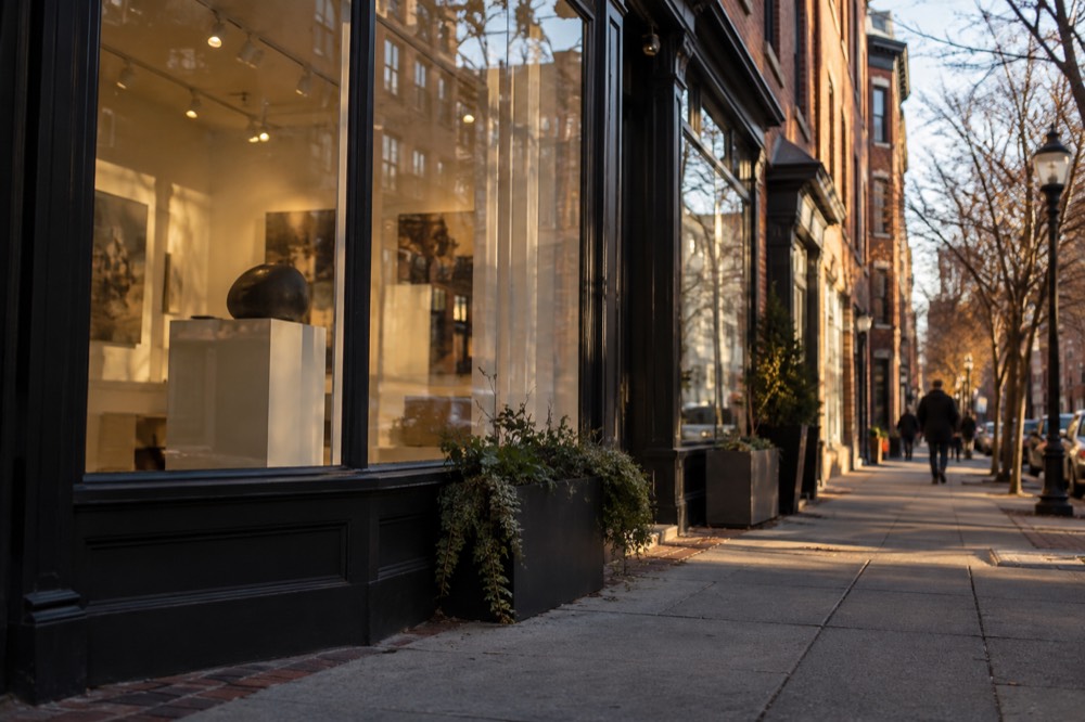
The SoWa Art + Design District, around Harrison Avenue in the neighborhood's southern blocks, is the closest thing the South End has to an anchor attraction: a concentration of galleries, studios, and maker spaces, with open-studio events that draw crowds on weekends. The Boston Center for the Arts on Tremont Street anchors the northern restaurant row with theaters and exhibition spaces in a former cyclorama building. Neither is a big-ticket museum, and that is the point of the district: the experience is the stroll.
The local South End food-and-history walk combines the neighborhood’s architecture with tastings. If you also visit Harvard on another part of the trip, the university has a free reserved historical tour and a separate paid student-led option; neither is a South End tour.
A useful planning table, with the caveat that gallery hours and event schedules change and should be confirmed on each venue's own page:
| Activity | Type | Typical time | Cost basis |
|---|---|---|---|
| Rowhouse squares walk (Union Park, Chester Park) | Self-guided | 1-2 hours | Free |
| SoWa Art + Design District galleries | Galleries and studios | 2-3 hours | Free to browse; event days vary |
| Boston Center for the Arts | Theater and exhibitions | Varies | Per event or exhibition |
| Tremont Street restaurant row | Dining | An evening | Per menu |
| Southwest Corridor Park walk | Linear park | 30-60 minutes | Free |
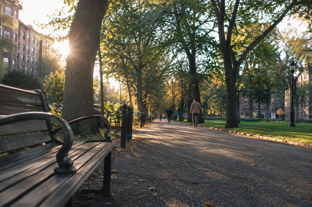
The Southwest Corridor Park, a linear greenway running along the Orange Line's path through the neighborhood, is the district's other free spine: a wide, tree-lined walking and cycling corridor that connects the South End to Back Bay stations and to Jamaica Plain beyond. It is the route many locals actually use to cross the neighborhood, and it is a better walk than the busier avenues.
Where Should You Eat In The South End?
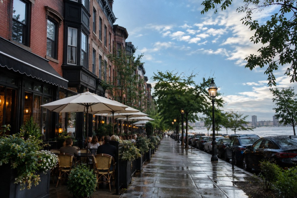
The South End's restaurant scene concentrates along Tremont Street, Columbus Avenue, and Washington Street, and it is one of Boston's most respected dining districts, spanning brunch cafes, oyster bars, and chef-driven dinner spots. Prices are set by each restaurant, so treat any figure here as a planning range rather than a promise; the reliable pattern is that the neighborhood skews toward mid-to-upscale dinner and long weekend brunch waits.
The practical advice is geographic. Tremont Street's lower blocks form the best-known row, dense enough that walking the street and reading menus works as a strategy. Columbus Avenue carries a second, slightly more casual band. Washington Street, running through SoWa, mixes restaurants with the galleries and has absorbed much of the newer openings. Weekend brunch is a neighborhood institution, and the waits at the best-known spots are real: arrive before 10am or expect to queue.
The obvious comparison, and the one most visitors are choosing between, is the North End, Boston's Italian district, which is a different kind of eating: pastry shops and red-sauce institutions rather than chef-driven menus. The deep dive on that side of town is the North End Italian restaurants guide. A guided option there is the Boston's North End Food Tour: Italian Flavors and Heritage Walk, a two-hour small-group walk whose listing shows 4.9 from 1,635 reviews, from $70 per person.
| Street | Character | Best for | Watch out for |
|---|---|---|---|
| Tremont Street | The flagship restaurant row | Dinner, oysters, wine bars | Weekend brunch waits |
| Columbus Avenue | Mixed casual and upscale | Weeknight dinner, cafes | Quieter on Sundays |
| Washington Street (SoWa) | Galleries plus newer kitchens | Lunch near galleries, event days | Hours tied to gallery schedule |
| Huntington Avenue | Institutional edge | Quick eats near venues | More chain and fast options |
One planning note that saves money: Boston's "free museum days" headlines are mostly residency benefits, not tourist perks. The MFA's open house days require a valid Massachusetts zip code, and its Card to Culture discount requires Massachusetts EBT, ConnectorCare, or WIC cards. The tourist-accessible exceptions, per the museums' own admission pages, are the MFA's $5 Third Thursdays, pay-what-you-wish with a $5 minimum on every third Thursday of the month after 5pm, and the ICA's free Thursday nights from 5 to 9pm, which the ICA's own hours page confirms for all visitors with advance tickets. The MFA's discounted-admission page lists the same Third Thursdays terms.
Where Should You Stay In The South End?
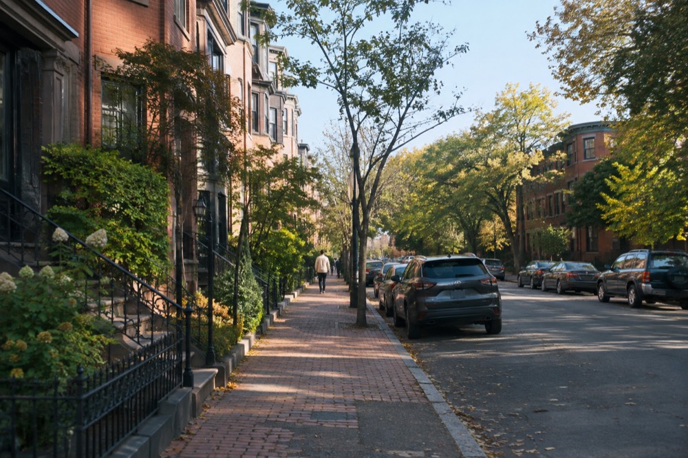
The South End is primarily a residential neighborhood with a limited hotel stock, so most visitors who want to sleep near it stay in adjacent Back Bay and walk in, while the South End's own options skew toward small inns and short-term rentals. There is no single verified price band worth printing for the district's lodgings; rates move with demand, and the honest planning advice is to compare against Back Bay and the Seaport on the dates you actually hold.
The trade-off is straightforward. Staying inside the South End puts a visitor inside the restaurant rows, which is the neighborhood's main evening draw, but the stock is thin and availability varies by date. Staying in Back Bay puts a visitor a ten-minute walk away with far more choice and the Orange and Green lines at the door. The Seaport is the newer, hotel-heavy alternative on the other side of Fort Point Channel, and the comparison between districts is covered in the where-to-stay guidance on the main things-to-do page.
For a visitor deciding between the South End and quieter residential districts, the honest framing is that the South End trades convenience for calm. Jamaica Plain and Brookline offer greener surroundings, with rates to compare for your dates but require a ride to reach the restaurant rows; the South End is the district where the evening is already at the door.
Compare exact hotel addresses and full stay totals before settling on a South End or nearby Back Bay base. This Boston map search is citywide and does not guarantee South End availability or cheaper rates. Compare Boston stays
When Is The Best Time To Visit The South End?
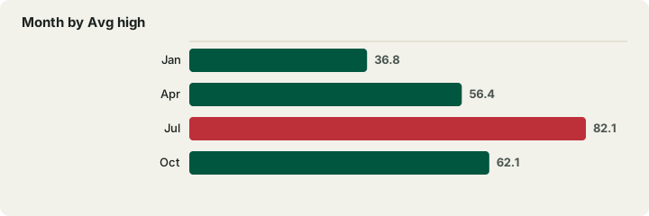
Late spring through early fall suits patios and longer neighborhood walks. Logan Airport’s NOAA normals show July as the warmest month, but monthly precipitation totals do not replace a forecast for your day. Winter visits can focus on restaurants, galleries and shorter outdoor stops.
The weather table below is drawn from NOAA's monthly normals, and it is the same data the National Weather Service uses for Boston. The South End's tree-lined squares and restaurant patios are at their best in the May-to-October window; winter strips the trees but gives the brick rows a spare, photogenic look, and the neighborhood's restaurants carry the season.
| Month | Avg high | Avg low | Precip (in) | Snow (in) |
|---|---|---|---|---|
| Jan | 36.8 | 23.1 | 3.39 | 14.3 |
| Apr | 56.4 | 40.8 | 3.63 | 1.6 |
| Jul | 82.1 | 66.0 | 3.27 | 0.0 |
| Oct | 62.1 | 47.5 | 4.03 | 0.2 |
One seasonal note worth carrying: the official Boston weather station sits at Logan Airport, on a harbor peninsula, so its readings are slightly maritime and can run a touch cooler than inland neighborhoods on a sea-breeze afternoon. It is still the right station for planning a visit to a waterfront-adjacent city.
How Does The South End Compare To Boston's Other Neighborhoods?
The South End is the brownstone-and-restaurants district: quieter and more residential than downtown, more food-driven than Back Bay's shopping core, and less touristed than the Freedom Trail corridor. Visitors with limited time should treat it as an evening and a stroll, not a full day of sights, and pair it with a ticketed attraction elsewhere in the city.
For contrast, Beacon Hill offers a comparable brick-and-gaslight atmosphere on the Freedom Trail side of downtown, while Charlestown carries the Navy Yard and the USS Constitution. The Theater District and Chinatown sit close to the South End's northeastern corner and make a natural before-dinner pairing. A visitor who wants the city's headline sights after a South End morning can reach the Freedom Trail sites from the neighborhood in one Orange Line ride, and 12 of the 16 Freedom Trail sites charge no admission at all, per the National Park Service's own hours-and-fees page.
For seeing the city from the water instead, the Boston Duck Boat Sightseeing City Tour with Cruise runs 1 hour 20 minutes, and its listing shows 4.6 from 10,003 reviews at a from-price of $62 per person. It is a different register from a quiet rowhouse square, and that contrast is exactly why the pairing works: a structured city overview in the morning, a slow neighborhood walk in the afternoon.
How Much Does A Visit To The South End Cost?
The neighborhood itself costs nothing to walk: the squares, the Corridor Park, and the gallery browsing are all free, so the real budget lines are transit and food. A visitor arriving by MBTA pays $2.40 per subway ride or $11.00 for a day of unlimited rides, and a dinner on Tremont Street is priced by each restaurant's own menu, with the neighborhood skewing mid-to-upscale. There is no district admission fee of any kind.
The honest budget frame, then, is that the South End is one of the cheaper districts to see and one of the more expensive districts to eat in. A visitor can hold a day's costs to transit plus one meal; a visitor who works through the restaurant rows should expect the dining line to dominate. The table below is a planning frame, not a price list.
| Budget line | Typical planning range | Notes |
|---|---|---|
| MBTA subway rides | $2.40 per ride | 1-Day pass $11.00; 7-Day $22.50 |
| Walking the squares and parks | Free | Union Park, Chester Park, Corridor |
| Gallery browsing in SoWa | Free | Event days may carry fees |
| Lunch, casual | Per menu | Bakeries and cafes keep this line low |
| Dinner, restaurant row | Per menu | Mid-to-upscale skew on Tremont |
For 1-Day and 7-Day passes, check the payment medium and activation rule when buying: CharlieTicket validity begins at purchase, while CharlieCard validity begins at first use. Contactless Tap to Ride is a separate pay-as-you-go method; tapping a bank card does not itself purchase a day or week pass.
How Does The South End Fit Into A Longer Boston Trip?
The South End earns an afternoon and an evening in most itineraries, and it pairs naturally with Back Bay, the Theater District, and the South End's own restaurant rows in a single day. Visitors on a first trip should see the Freedom Trail corridor and the waterfront before allocating a full day here; visitors on a second or third trip often make the neighborhood the whole point of the visit.
A harbor outing can precede a South End dinner, but allow for check-in, the return and the journey inland. The narrated Long Wharf cruise lasts about one hour. Whale watches usually take three to four hours and can run longer, so leave a substantial buffer before a fixed dinner reservation; confirm the whale-watch dock on your ticket.
For visitors building a full itinerary, the one-day and multi-day plans on this site fold the South End into larger routes, and the downtown and Financial District page covers the corridor the Orange Line connects through. The neighborhood's own scale is the thing to respect: it is best at walking pace, and it does not reward a rushed checklist.
Would a narrated harbor outing complement your South End visit? Explore the one-hour cruise from Long Wharf and allow time to cross downtown. Food and drinks are extra; the boat does not depart from the South End. Check harbor cruise departure times
Common Questions About The South End, Boston
Is the South End the same as South Boston?
No. The South End is the inland brownstone neighborhood south of Back Bay; South Boston is the separate peninsula across Fort Point Channel. They are different neighborhoods with different histories, and locals never confuse them.
Is the South End walkable?
Very. The core blocks between Massachusetts Avenue and the Back Bay edge take about twenty minutes to cross at a sightseeing pace, and the restaurant rows are best approached on foot. The Southwest Corridor Park gives the neighborhood a car-free walking spine.
How do I get to the South End from Logan Airport?
The Silver Line SL1 is free leaving the airport from the terminal curb to South Station, per Massport's own transport page. At South Station, use the included Red Line transfer, then change within the paid area at Downtown Crossing to the Orange Line for Back Bay; walk into the neighborhood from there.
What is the best time of year to visit the South End?
May through October often suits outdoor walking and patios, while restaurants and galleries offer reasons to visit year-round. Check the forecast and venue calendar; similar monthly precipitation totals do not mean equal rain risk on every day.
Are the South End's art galleries free?
Browsing the SoWa galleries and studios is generally free, but hours vary and some open-studio and event days carry their own terms. Check each venue's own page before planning a visit around them.
Is the South End good for a first visit to Boston?
As a half-day, yes: it pairs well with Back Bay and the Theater District. First-time visitors should see the Freedom Trail corridor and the waterfront first, then give the South End an unhurried afternoon and dinner.
Choose Your South End Food Walk Or Nearby Stay
These options do not match your choice. Adjust the selection or reset to explore the starting recommendation.
Compare Your South End Visit Totals
Reader-entered estimates in USD, not live quotes. Use the same dates and travelers for both options. Include all relevant tickets, rooms, taxes, mandatory fees and transport for the entire trip once in each total. Do not add a transfer twice if your rate already includes it.
South End Food And Neighborhood History Walk
A three-hour South End walk with meal-sized tastings, primarily seated indoors between outdoor walks. Ages 12+; no infants, toddlers or strollers. Only listed dietary adjustments are available with advance notice, including vegetarian and non-celiac gluten-free; confirm specific needs. Exact meeting location can vary. Transport, tips and extra purchases are separate.
A starting option to explore. Choose dates, travelers and the exact booking option with the provider; availability and eligibility are confirmed there.
Check South End food walk dates and dietary terms