East Boston
East Boston sits across the harbor from downtown, holds Logan Airport, and pays for that with airplane noise and pays itself back with the best skyline views in the city. The MBTA's own fare pages and Massport's airport guides cover the logistics in detail, and the neighborhood itself, Eastie to the people who live there, is one of the few parts of Boston where the water, the airport and the immigrant food scene all sit within a mile of each other. This guide from Boston Travel Guide covers what the area actually offers a visitor: how to get in and out, what to do along the waterfront, where to eat, and whether it belongs on your itinerary at all.
Short answer
East Boston is known for three things: Logan Airport sits inside its borders, its harborfront parks give the clearest skyline views in the city, and its food scene reflects more than a century of immigrant communities, from Italian to Central American, spread across compact squares like Maverick and Central. It is a residential neighborhood of roughly 5 square miles separated from downtown by the harbor, connected by the Blue Line tunnel and the Sumner, Callahan and Ted Williams tunnels.
East Boston sits across the harbor from downtown, holds Logan Airport, and pays for that with airplane noise and pays itself back with the best skyline views in the city. The MBTA's own fare pages and Massport's airport guides cover the logistics in detail, and the neighborhood itself, Eastie to the people who live there, is one of the few parts of Boston where the water, the airport and the immigrant food scene all sit within a mile of each other. This guide from Boston Travel Guide covers what the area actually offers a visitor: how to get in and out, what to do along the waterfront, where to eat, and whether it belongs on your itinerary at all.
Staying for an early flight? Explore Hilton Boston Logan Airport and check the terminal connection for your itinerary. For a neighborhood stay, use the hotel map to compare the actual address and Blue Line access. Check rooms at Hilton Boston Logan Airport
What Is East Boston Known For?
East Boston is known for three things: Logan Airport sits inside its borders, its harborfront parks give the clearest skyline views in the city, and its food scene reflects more than a century of immigrant communities, from Italian to Central American, spread across compact squares like Maverick and Central. It is a residential neighborhood of roughly 5 square miles separated from downtown by the harbor, connected by the Blue Line tunnel and the Sumner, Callahan and Ted Williams tunnels.
The geography is the story. East Boston is a peninsula of its own, boxed in by the Chelsea Creek on one side and the harbor on the other, and for most of the city's history it was a place you passed through on the way to somewhere else. Shipyards built clippers here in the neighborhood's early decades. Later it became the landing point for wave after wave of new arrivals, and that layered history still shows in the neighborhood's squares, its churches and its restaurants.
The airport changed everything. Logan was built on filled land at the neighborhood's eastern edge, and today East Boston is the part of Boston most visitors touch first, usually without realizing it. The runways sit between the houses and the sea, which is why plane spotting is a genuine local pastime and why Massport insulates hundreds of homes for sound.
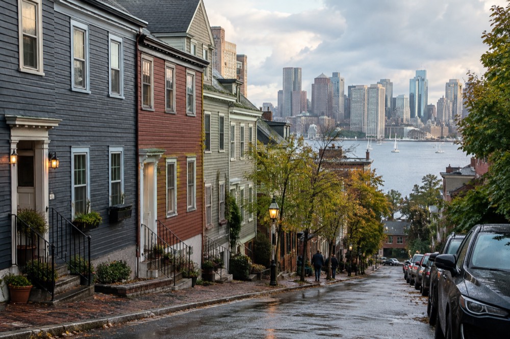
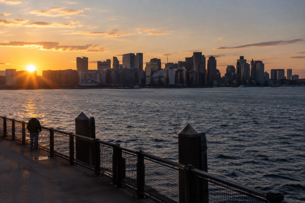
What surprises first-time visitors is that the neighborhood is genuinely pleasant to walk. The hills of Eagle Hill and Orient Heights rise above the harbor, the Harborwalk threads along the water at Jeffries Point, and from Piers Park the entire downtown skyline, from the Custom House to the Seaport, sits framed across the water. Few postcard views of Boston are actually photographed from Boston's tourist districts. Many are shot from right here.
How Do You Get To East Boston From Logan Airport?
The Silver Line SL1 bus is free leaving the airport: Massport states plainly that it provides free service between the terminals and South Station from the terminal curb, so an arriving visitor can reach the subway network without paying anything. Going the other way, toward Logan, the same ride costs the standard $2.40 subway fare. Massport also runs free shuttle buses connecting the terminals to the Blue Line at Airport station, to the water ferry dock, to Economy Parking and to the Rental Car Center.
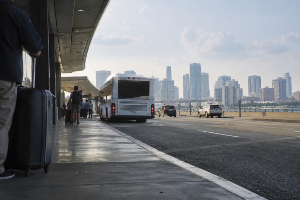
That free SL1 leg is the single most useful fact in Boston airport logistics, and Massport publishes it on its own to-and-from Logan page. Board at the terminal curb, ride to South Station, and transfer to the Red Line or walk into downtown without ever tapping a fare. If you are heading into East Boston itself rather than downtown, take the free Massport shuttle to the Blue Line's Airport station instead; the Blue Line runs through the neighborhood at Maverick, which is the square most visitors mean when they say Eastie.
The MBTA's fare table gives the numbers a visitor needs. A subway ride is $2.40, a local bus is $1.70, a 1-Day pass is $11.00 and a 7-Day pass is $22.50. Since 1 September 2026 there is also an unlimited-transfer pilot: within a two-hour window, using the same payment method, you can transfer between subway, bus and ferry as many times as you like and pay only the highest-priced leg. The MBTA fare pages carry the details.
| Option | Cost | Where It Goes | Notes |
|---|---|---|---|
| Silver Line SL1 from terminals | Free from the terminal curb | South Station, then Red Line | Free only leaving the airport; $2.40 toward Logan |
| Massport on-airport shuttle | Free | Blue Line Airport station, ferry dock, parking, rental cars | Runs between all terminals |
| Blue Line from Airport station | $2.40 | Maverick, Aquarium, Government Center, Bowdoin | Two stops to downtown |
| Logan Express bus | Fare varies by route | Back Bay, Braintree, Danvers, Framingham, Woburn | Massport lists routes and fares on its site |
| Water taxi | Fare varies by destination | Downtown and waterfront landings | Seasonal and weather dependent |
Massport’s phase-two Runway 9–27 work began August 31, 2026, with very limited runway availability over about 75 days. This is not a full runway closure for the entire period. Check the current roadway and airline notices; older terminal bridge or play-area announcements must not automatically be assigned to 2026.
Further reading: roadway and construction updates page.
If your plan is to sleep near the airport and sightsee downtown, East Boston is honestly a reasonable base: Maverick Square to Government Center is a handful of Blue Line stops. And once you are settled, the rest of the city opens up fast. A guided walk is the most efficient first move, and the Harvard University Campus Guided Walking Tour, from $23 per person and rated 4.7 across 3,864 reviews on its listing, is a structured way to see Cambridge's side of the river without planning it yourself.
If you would rather compare a few options at once, these three cover the classic Boston first-day moves: a campus walk, a food walk, and the amphibious sightseeing tour everyone photographs.
Want a prebooked arrival ride instead of transferring? Compare a Logan-to-hotel quote for your exact East Boston address, flight, bags and party. Free airport shuttles and the Blue Line remain alternatives. Get a Logan pickup quote
What Are The Best Things To Do In East Boston?
The best things to do in East Boston are the waterfront ones: Piers Park at Jeffries Point for the skyline view, the Harborwalk stretch along Lewis Mall, Constitution Beach for swimming and plane watching, Belle Isle Marsh for salt marsh trails, and East Boston Memorial Park for ballfields and green space. None of them charges admission, and most sit within a short walk of a Blue Line station.
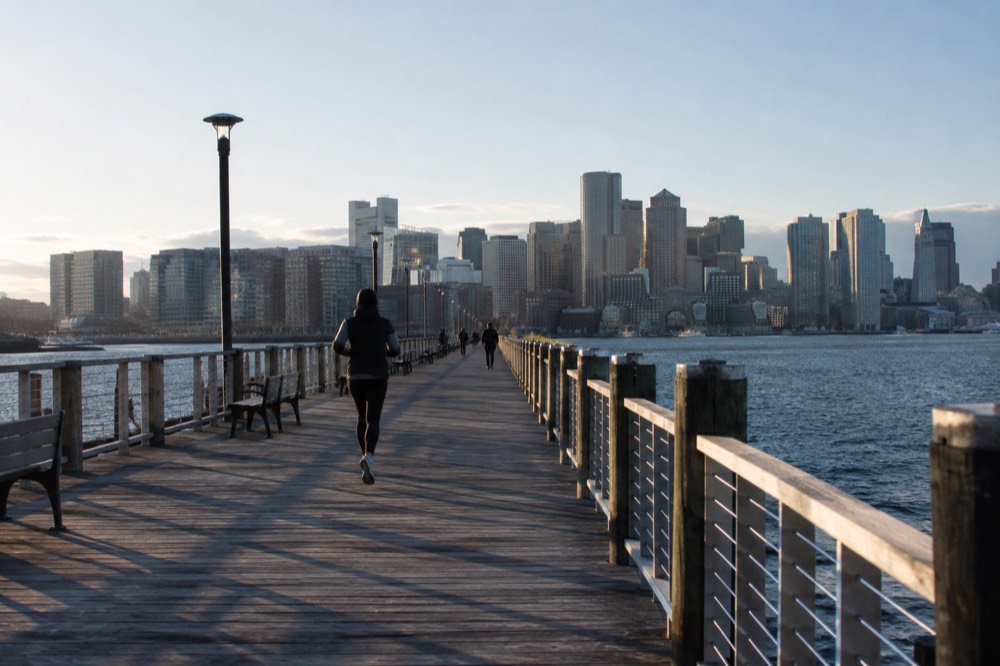
Piers Park is the headline. The pier extends out into the harbor with the downtown skyline directly opposite, and on a clear evening it is one of the few places in the city where you can watch the light move across the whole downtown at once. The park sits at the foot of Maverick's hillside streets, so the walk down from the Blue Line is part of the experience. A community sailing center operates from the park, and the surrounding Jeffries Point streets are among the quietest walkable blocks in the neighborhood.
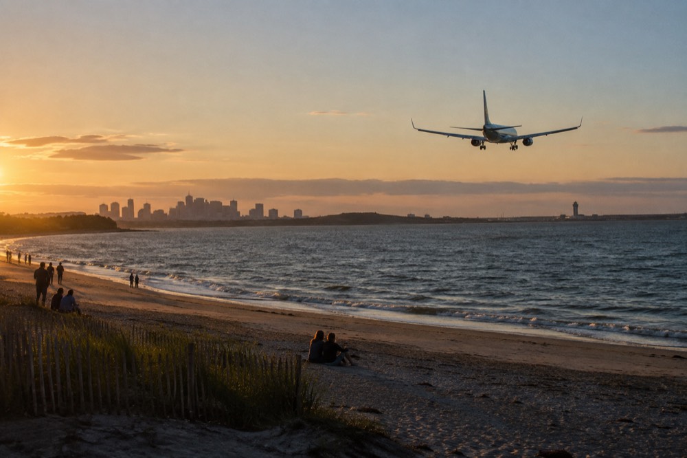
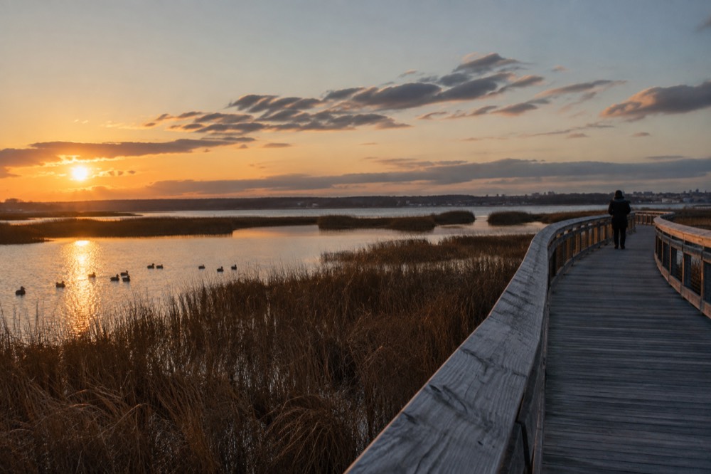
Constitution Beach, on the neighborhood's northeast side, faces the harbor islands and the airport's runway approach at the same time. That combination, swimming and plane spotting, is genuinely East Boston: you can lie on the sand and watch widebodies descend overhead. Belle Isle Marsh, at the edge where East Boston meets Revere, is the last sizeable salt marsh in the city, with boardwalk trails and bird life that feel a long way from Logan's runways even though they are minutes from them.
| Spot | What It Is | Best For | Getting There |
|---|---|---|---|
| Piers Park | Harborfront park with a pier and skyline view | Sunsets, photographs, sailing | Short walk from Maverick station |
| Harborwalk at Jeffries Point | Waterside walkway past Lewis Mall | A slow waterfront stroll | Continues from Piers Park |
| Constitution Beach | Sandy beach with bathhouse | Swimming, plane spotting | Blue Line to Orient Heights plus a walk |
| Belle Isle Marsh | Salt marsh reservation with boardwalks | Birding, quiet trails | Edge of the neighborhood near Revere |
| East Boston Memorial Park | Large neighborhood park | Ballfields, playgrounds, casual green space | Between Maverick and Orient Heights |
For a wider view of the harbor, the ferry system runs from the downtown side. The Boston Harbor Islands ferry's 2026 season runs through Monday 12 October, with the fall schedule operating Thursdays through Sundays from 10 September to 27 September; check the current passenger fares and the selected island’s dated schedule before booking. The islands sit directly across the channel from East Boston's waterfront, so the neighborhood is one of the best places on the mainland to watch the ferries come and go.
A harbor cruise offers a view from the water; the amphibious Duck Tour is a different outing on the Charles River. The Boston Duck Boat Sightseeing City Tour with Cruise runs from $62 per person, is rated 4.6 across more than 10,000 reviews on its listing, and splashes down into the Charles after a city drive, which gives the same skyline-plus-water perspective that East Boston's parks give for free, plus a guide doing the storytelling.
Where Should You Eat In East Boston?
East Boston's food scene runs on two traditions: the old Italian presence around Maverick and Eagle Hill, best represented by the pizza at Santarpio's, one of the city's most famous pizzerias, and the newer Central American and Mexican kitchens along Chelsea Creek and in Central Square, plus a growing set of waterfront restaurants at Liberty Plaza and Jeffries Point that trade on the skyline view. Taquerias, pupuserias and Italian bakeries sit within blocks of each other.
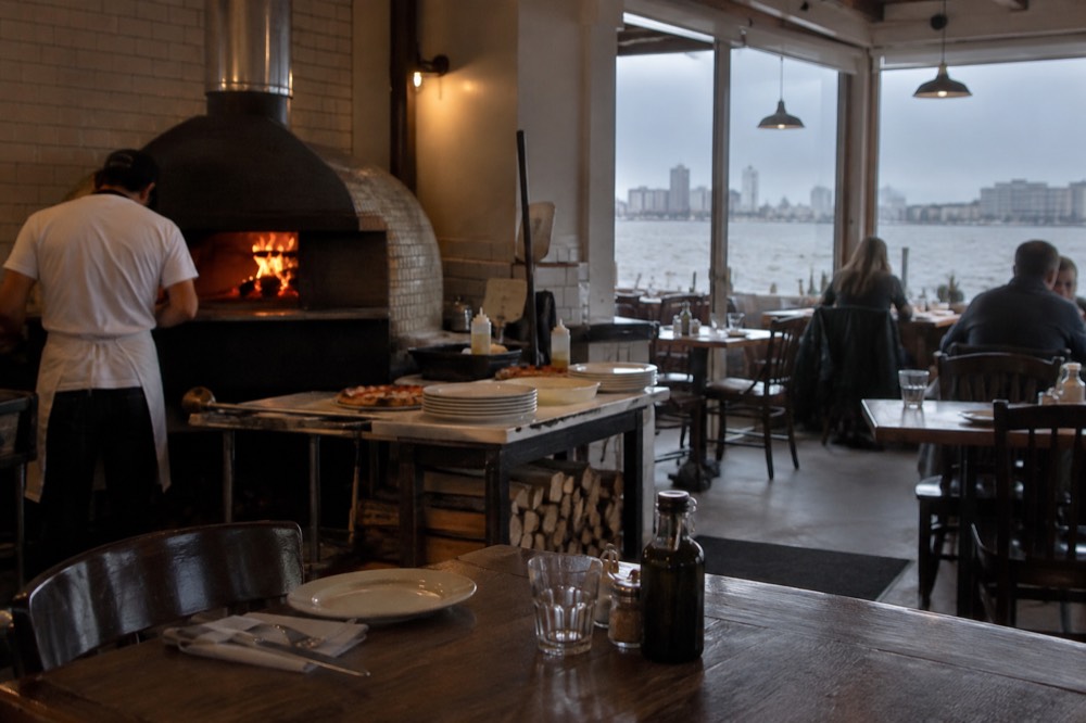
Santarpio's is the anchor name, a bar-and-pizza institution on Chelsea Street that predates most of the neighborhood's restaurants and draws people from across the city for its thin, charred pies and grilled meats. Around it, the Eagle Hill streets hold Italian bakeries and small markets that have served the same families for generations. This is the older layer of Eastie's food identity, the one that earned the neighborhood its reputation before the airport expanded.
The newer layer is Central American. East Boston has one of the largest Latin American communities in New England, and the taquerias, pupuserias and mariscos counters along Meridian Street and in Central Square are where the neighborhood actually eats on a Tuesday. The prices are modest and the cooking is the real thing, which is why Eastie has quietly become a destination for people who live in other parts of the city.
| Food Stop | Style | Neighborhood Layer |
|---|---|---|
| Santarpio's | Pizza and grilled meats | Old Italian Eastie |
| Eagle Hill bakeries | Italian breads, pastries, subs | Old Italian Eastie |
| Meridian Street taquerias | Tacos, burritos, mariscos | Latin American Eastie |
| Central Square pupuserias | Salvadoran and Guatemalan cooking | Latin American Eastie |
| Jeffries Point waterfront | Harbor-view dining and drinks | Newer development |
If the meal is the point of the evening rather than the view, the North End across the harbor is the city's canonical Italian district, and a guided food walk is the most efficient way to eat your way through it. The Boston's North End Food Tour: Italian Flavors and Heritage Walk runs from $70 per person, is rated 4.9 from 1,635 reviews on its listing, and covers the historic district's food stops with the stories attached.
Eastie’s own kitchens reward an independent neighborhood evening. For any separate guided experience, check the actual payment and cancellation terms before booking.
Is East Boston's Waterfront Worth the Trip on Its Own?
Yes, especially for harbor views and public waterfront walks. The area also has commercial destinations, including The Tall Ship’s moored floating-bar venue at Pier One; it is not correct to say there are no venues. That venue is distinct from a sailing cruise, and public park access has its own hours.
The practical version: take the Blue Line to Maverick, walk down to Piers Park, do the Harborwalk stretch, then pick a dinner spot based on whether you want pizza, tacos or a view. That is a two-to-three-hour visit, it costs nothing beyond the fare, and it delivers the single most photographed angle of Boston that most visitors never see in person. It also pairs well with a harbor crossing: the North End and the downtown waterfront are one Blue Line stop and a short walk away, so an Eastie evening slots neatly into a larger day.
Is East Boston A Good Place To Stay?
East Boston can work for airport access and Blue Line connections, depending on the exact property. Compare actual rates instead of assuming every room is cheaper than downtown. An airport-campus hotel and a neighborhood address have different terminal and station connections; neither places you on the downtown historic walking route.
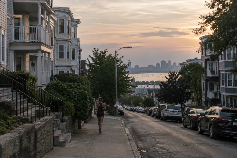
The honest comparison is against the neighborhoods visitors usually pick. Back Bay and Beacon Hill put you inside the postcard but charge accordingly. The North End trades hotel supply for atmosphere. Charlestown and South Boston sit on the downtown side of the water, and Dorchester spreads south with its own transit lines. East Boston's pitch is simpler: you give up walk-to-everything and you get skyline views, airport proximity and generally cheaper rates.
| If You Want | Better Fit Than East Boston | Why |
|---|---|---|
| Walk to the Freedom Trail | Downtown and Financial District | The trail starts there |
| Historic streets and atmosphere | Beacon Hill or the North End | Eastie's charm is residential, not colonial |
| Waterfront dining scene | Waterfront and Long Wharf | Closer to the ferry terminals and downtown |
| Stay near downtown transit | Compare East Boston properties | Check actual room totals and Blue Line walking distance |
| Early flight out of Logan | East Boston itself | Minutes from the terminals |
Assess the specific property, route and return service rather than relying on a broad neighborhood label. South Boston is a different neighborhood across the water, so advice about it is not an assessment of East Boston.
Would an airport-campus night suit your early flight? Explore Hilton Boston Logan Airport’s rooms and current terminal connection. Compare the full rate and transport arrangements; airport location does not guarantee the lowest price. Check rooms at Hilton Boston Logan Airport
What Does A Day In East Boston Look Like?
A realistic East Boston day: arrive on the Blue Line or the free airport shuttle in the morning, walk the Eagle Hill streets down to Piers Park, follow the Harborwalk to Jeffries Point, eat lunch at a Meridian Street taqueria or at Santarpio's, spend the afternoon at Constitution Beach or Belle Isle Marsh, then close with a sunset at the pier and dinner with the skyline in view. It is a half-day or a full day depending on how long you linger, and it costs almost nothing.
The morning is the neighborhood's best light. The skyline faces west, so by afternoon the towers are backlit and by evening they catch the sunset. Photographers who want the classic shot time their Piers Park visit for the last two hours of daylight; anyone who wants the beach and the marsh should flip the order and save the pier for the end.
| Time | Plan | Notes |
|---|---|---|
| Morning | Maverick Square, then walk downhill to Piers Park | Coffee and bakeries around the square |
| Midday | Harborwalk to Jeffries Point, lunch on Meridian Street or Chelsea Street | Pizza or tacos, both within reach |
| Afternoon | Constitution Beach or Belle Isle Marsh | Beach for planes, marsh for birds |
| Evening | Sunset at the pier, waterfront dinner | The skyline does the entertaining |
The Blue Line connects East Boston with Aquarium, State and Government Center. For Harvard Square in Cambridge, one route is Blue to Government Center, Green to Park Street, then Red toward Alewife; Government Center has no direct Red Line connection. The Seaport needs a separate walk or transit connection. The things-to-do overview covers the wider city.
For a multi-day harbor trip, separate your East Boston walks from any guided outing departing across the water.
Common Questions About East Boston
is east boston a good place to stay?
It is a good base for airport access and budget-conscious trips, with quick Blue Line service to downtown. It is a weaker choice if you want to walk out your door into the historic core, because Eastie is residential and sits across the harbor from downtown.
is the silver line really free from logan airport?
Yes, in one direction. Massport states that the Silver Line SL1 provides free service between the terminals and South Station from the terminal curb, so the ride leaving the airport costs nothing. Riding toward Logan from South Station costs the standard $2.40 subway fare.
what is the best view of the boston skyline?
Piers Park in East Boston is the strongest candidate. The pier looks straight across the harbor at the full downtown skyline, from the North End to the Seaport, and it is free and open to the public.
how do I get from east boston to downtown?
Take the Blue Line from Maverick or Airport station toward Government Center or Bowdoin. The ride to Government Center is a few stops, and from there the Green Line and downtown on foot take over.
is east boston safe for visitors?
East Boston is a working residential neighborhood where ordinary city awareness applies, as it does across the transit network. The waterfront parks and main squares are busy and well used by local families.
does east boston have beaches?
Yes. Constitution Beach is a sandy swimming beach with a bathhouse on the neighborhood's northeast side, and it doubles as one of the best plane-spotting spots in the city.
Choose Your East Boston Base Or Arrival Plan
These options do not match your choice. Adjust the selection or reset to explore the starting recommendation.
Compare Your Airport And City Stay Totals
Reader-entered estimates in USD, not live quotes. Use the same dates and travelers for both options. Include all relevant tickets, rooms, taxes, mandatory fees and transport for the entire trip once in each total. Do not add a transfer twice if your rate already includes it.
Hilton Boston Logan Airport
An airport-campus hotel for a flight-focused overnight stop. Check the current terminal connection and rate conditions before booking.
A starting option to explore. Choose dates, travelers and the exact booking option with the provider; availability and eligibility are confirmed there.
Check rooms at Hilton Boston Logan Airport